Stephenson Canyon Park Trails

City of Bremerton Neighborhood Park

Stephenson Canyon Park is an asset to those who live or work nearby, but its small size makes it less appealing to those coming from further away.

Trails in this compact park seem longer than they are, officially, about 1 – 1/2 mile.

Optional routes outside the park will take you to the waterfront Lions Park.

Pros

Cons

Stephenson Canyon Park Trail Maps

The maps below show trails within the park as well as a suggested route through a nearby waterfront park.  Use the left and right arrows to browse these maps

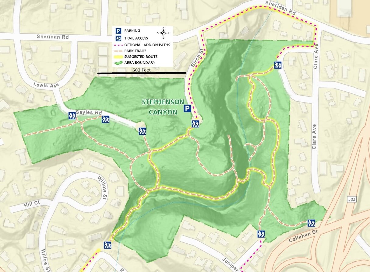
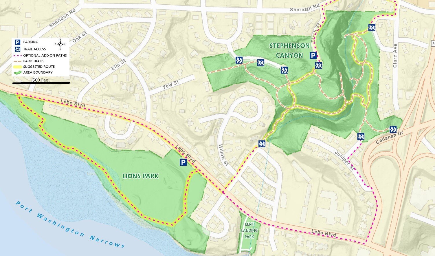
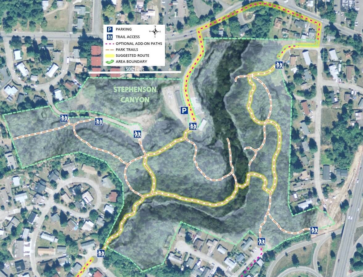
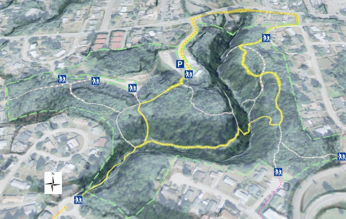
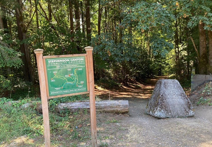
The City of Bremerton calls Forest Ridge Park a neighborhood park and it is just that.  An asset to those who live, work, or shop nearby, the park and adjoining areas offer multiple walking opportunities.

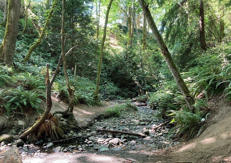
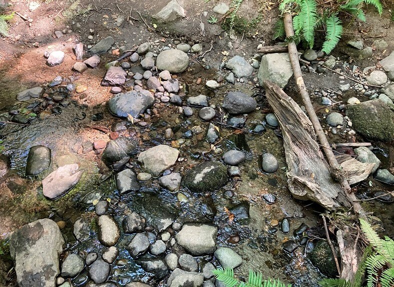
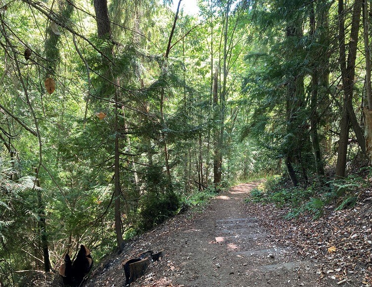
Hiking trails here climb and descend the canyon surrounding a small creek.  If you prefer not to take on the hills, stay on the trails along the ridge and the trail segments that veer way from the canyon.

Similar to the other neighborhood parks featured here, combine multiple trail segments and walking routes outside the park to compose a pleasing hike.

When crossing the Warren Ave Bridge to East Bremerton, Stephenson Canyon is the forested area to your left.

Enter from the main parking lot off Sheridan Rd. or any of the neighborhood trailheads.  Optionally park at Lions Park on Lebo Blvd and walk the waterfront path.  For an even longer walk, continue down Lebo Blvd. past the bridge and the hospital to Madrona Trails Park.

Additional Maps

The map below provides a different perspective on Stephenson Canyon Park trails and the surrounding area with satellite imagery and elevation hillshading

3D Maps

See the map below for more realistic 3D perspective views of Stephenson Canyon Park and its topography

For more information, visit the authoritative Stephenson Canyon Park page