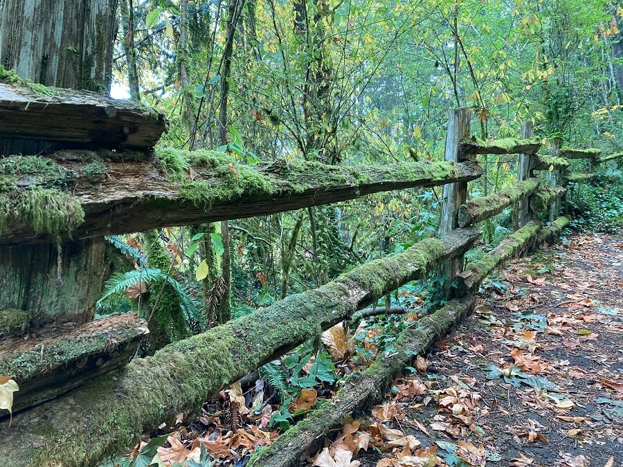
A visual guide to hiking trails, walking paths, and mountain bike routes in and around Bremerton, Silverdale, and Port Orchard as well as destinations throughout north, central, and south Kitsap County
Are any good hiking trails near me? Browse the maps and pictures below and throughout this site and learn how to use the detailed trail maps for real-time navigation on the trail or jump directly to your favorite hiking trail or the interactive trail map with the links at the top or bottom
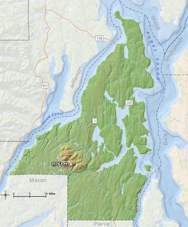
The places where we live as well as our parks and recreational trails are distributed throughout Kitsap county, a region dominated by water, coastline, and uneven terrain, illustrated by the first pair of maps below.
Endless opportunities for outdoor recreation abound here and stretch from within our local communities to the most remote parts of the Kitsap Peninsula.
* Some maps and pictures can be enlarged by clicking the item
Kitsap County Topography
Kitsap County General Reference
Where are the parks and hiking trails and who manages them?
Hiking trails, walking paths, and unpaved mountain bike routes can be found in and around municipal, county, tribal, and state parks, in addition to areas managed by nonprofit organizations, neighborhood associations, and various private entities , but how do we find them?
The majority of parks in Kitsap County do not feature trails of significant length and successfully navigating through all of the possible choices is the key to finding good trails. Without the right information, the multitude of prospects can be overwhelming.
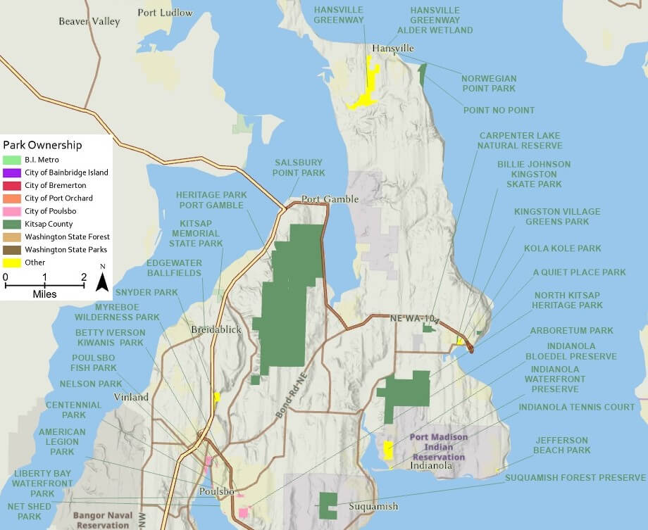
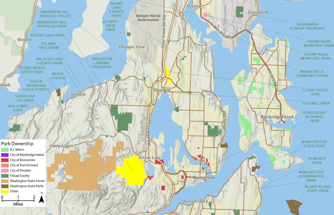
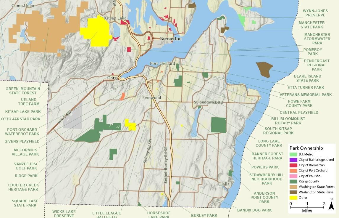
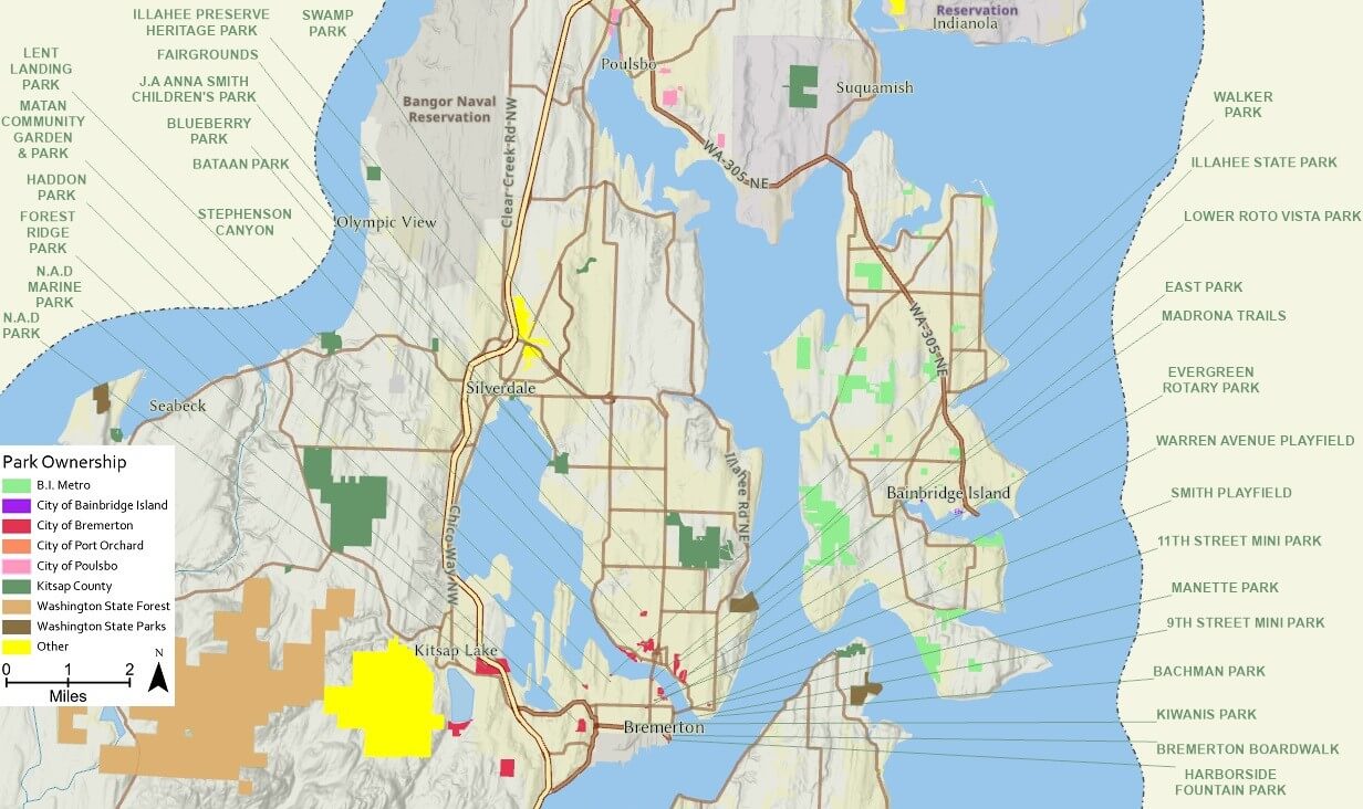
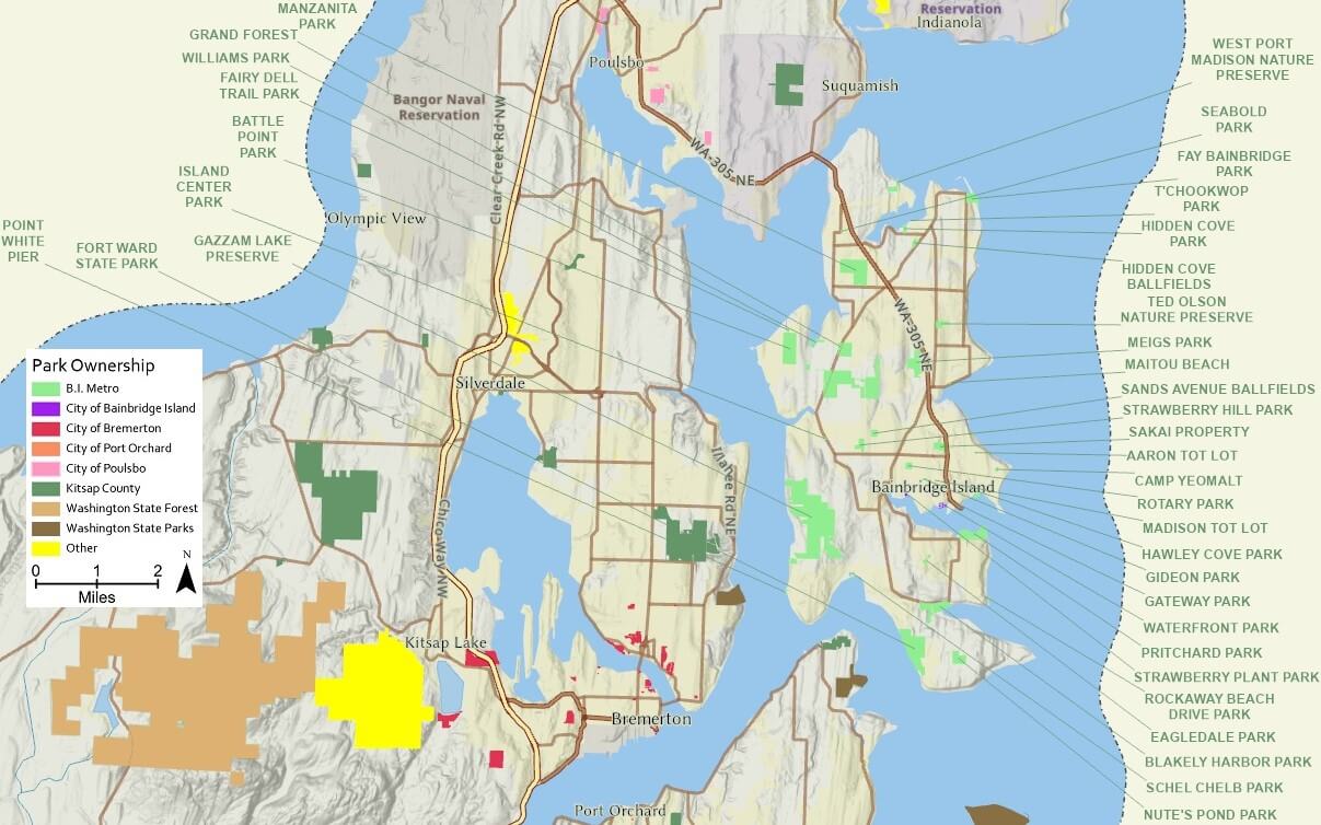
The maps below present all of the parks located in and around Bremerton, Silverdale, Port Orchard, Kingston, Poulsbo, and throughout Kitsap County, identifying the responsible agency or steward with unique colors.. Using the left and right arrows below, browse through each of the five vicinity maps to visualize the distribution of our parks. Only a fraction of them have enough recreational trails to justify creating trail maps.
North Kitsap Parks
Central Kitsap Parks
South Kitsap Parks
Bremerton Area Parks
Bainbridge Island Parks
Hiking Trail Maps
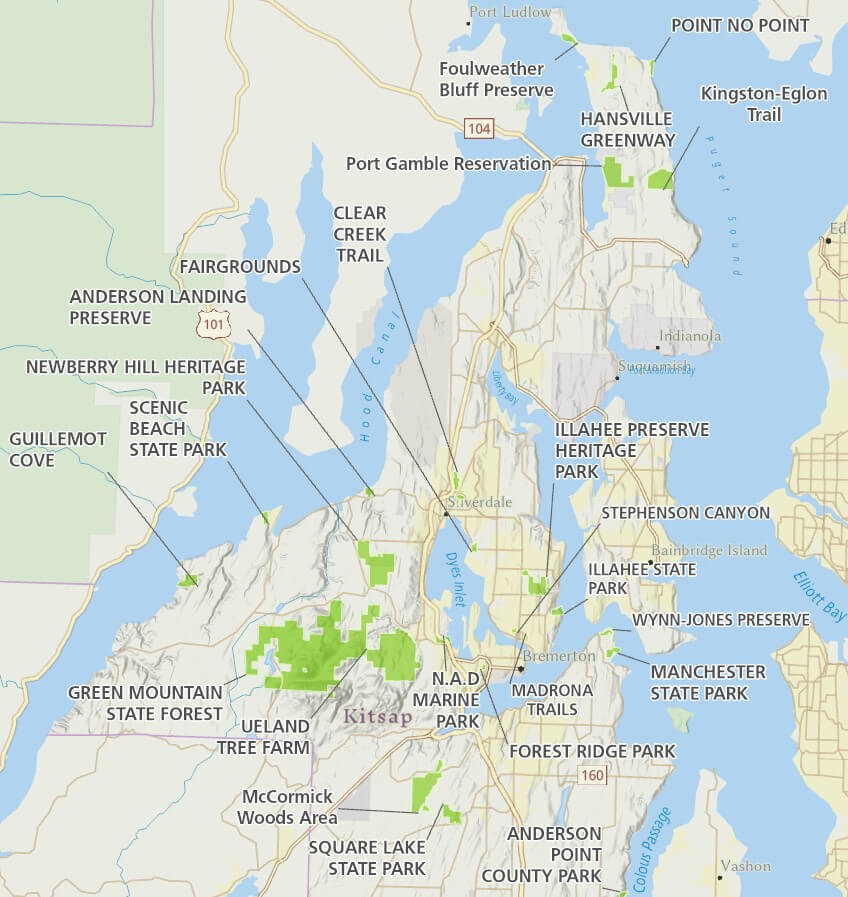
The map below identifies the trail maps currently available on this site, spanning the entire county from Kingston to Hansville in north Kitsap and Silverdale, Bremerton, Port Orchard and south Kitsap County. Bainbridge Island trails are not currently available here.
Trail Map Availability
Trail Maps
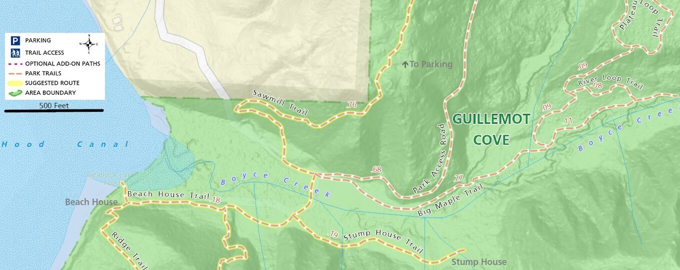
Below you will see a small sample of the trail maps available for each park and trail system featured on the Parks & Trails page. To help you visualize each potential destination, choose a park to open one ore more general purpose trail maps, each optimized for easy on-screen viewing and displaying points of interest, parking and trail access locations, trail names, distance between trail intersections, and suggested routes as well as 3D perspective maps with satellite imagery and elevation.
Large parks with longer trails, including Hansville Greenway, Clear Creek Trail, Green Mountain, Ueland Tree Farm, Illahee Preserve, Newberry Hill, and others are introduced with a generalized overview trail map followed by detailed section maps. Each place additionally features an oversized and detailed whole-park trail map for easy display or download (best with fast connection) as shown in this example: Clear Creek Trail.
Guillemot Cove Nature Reserve Trail Map Sample
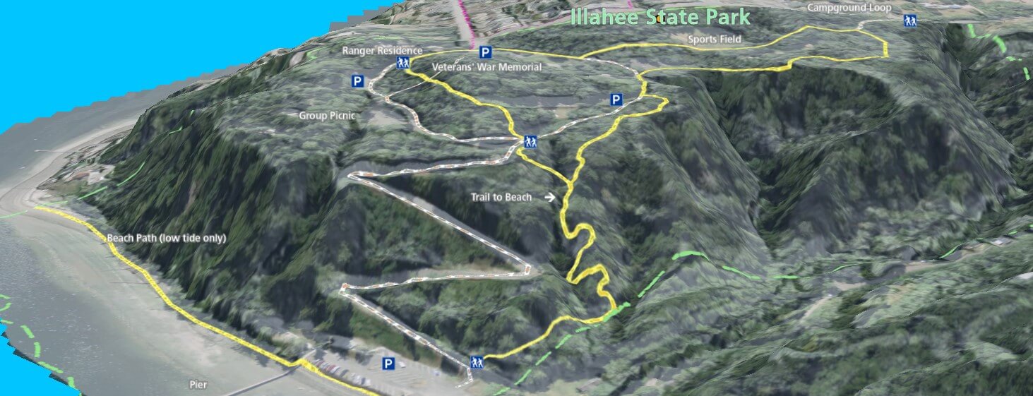
Illahee State Park 3D Trail Map Sample
Trail maps for each park presented here are now easily accessible with the free Maprika app for real-time navigation on the trail using your smartphone. Monitor your position on or off the trail as you go and feel confident that you will never get lost again, even in areas with no reception and unnamed trails. Install the app and download maps before you go. Search for KitsapTrailGuide in Maprika to easily access these maps.