Illahee Preserve Heritage Park Trails

A prime example of preservation in action

Illahee Preverve Heritage Park has a well-developed trail system meandering through mature forest and allowing you to find a natural escape from nearby busy roads and box stores.

Closer to the urban core than most county parks, Kitsap county and other organizations have actively expanded the forest preserve boundaries to protect adjacent areas for the benefit of current and future generations.

Pros

Cons

Illahee Preserve Trail Maps

The map series begins with a generalized overview map of the entire Illahee Preserve Trail system.  The lengthy trail network is also illustrated in two detailed section maps.  Use arrows on either side of the map frame to view the complete series.  Each map is optimized for easy on-screen viewing without the need for magnification on large screens.  Optionally, click to view and/or save a full-size map of the entire Illahee Preserve Heritage Park and its trails.

With about 570 acres of mature forest right in the middle of Bremerton’s urban jungle, the Illahee Preserve is so enticing because it only takes a few minutes to penetrate the forest and venture beyond noise from the nearby busy roads.

The forest was cut in the distant past, but many trees were also spared, leaving behind an array of giant old trees to walk through.  The preserve was targeted for protection early enough to keep it intact and it continues to be a gem today offering about 5 miles of trails.

Illahee’s trails are well maintained and easy to walk with rolling, but not overly steep terrain.  All rails are mostly free of undergrowth and any obstructions that can make walking difficult in other places.  This is one of those places where you can wear just about anything and not worry about getting dirty.

Many of the trails form loops so you can start at any of the trailheads and walk for 20 minutes or an hour or longer depending on how far you want to go. With such high-quality trails and surrounding forest, there is little incentive to offer any suggested routes.  Any path you choose will be a good one.

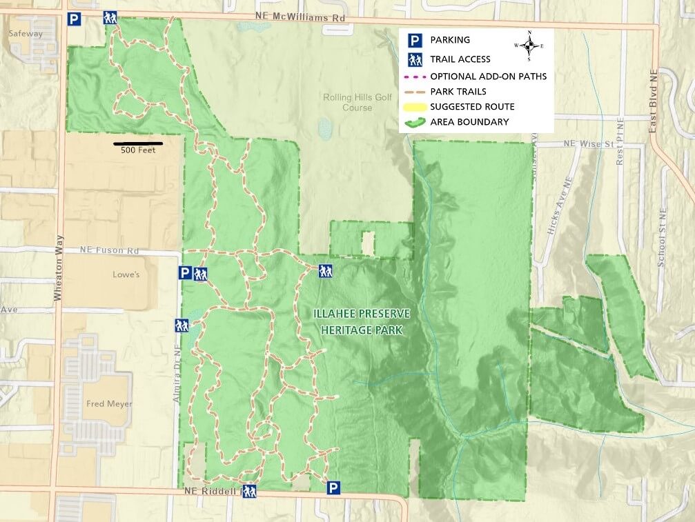
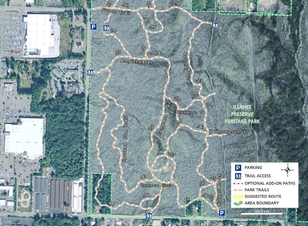
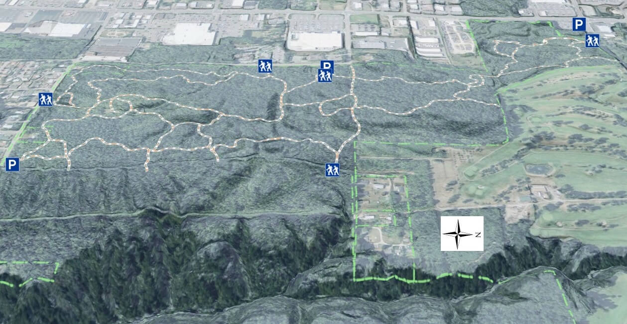
An examination of the map will reveal that the western half (almost) where the trails are is quite level when compared to the steeper eastern portion, which is off-limits to hikers.

Although there is nothing preventing you from riding a mountain bike here, I strongly recommend that you traverse the area on foot.  Too many people use the trails and they are generally not wide enough to easily accommodate both bikers and hikers.  Even though you may find crowded parking lots at times, the preserve’s trails never feel crowded at all.

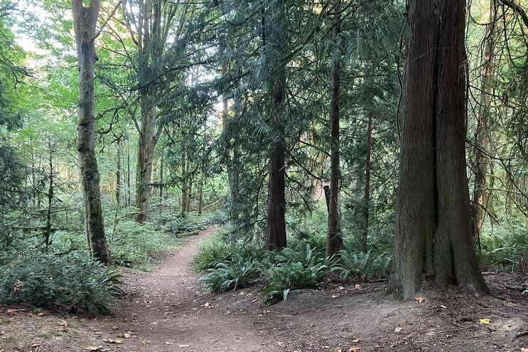
Illahee Preserve Heritage Park is so close to a number of amenities that I often combine a 30-minute walk with a necessary trip to one or more nearby stores before returning home.  Although not necessarily a destination park with hours of hiking options, I consider this a place worth taking advantage of when you need a short retreat from the nearby urban chaos.

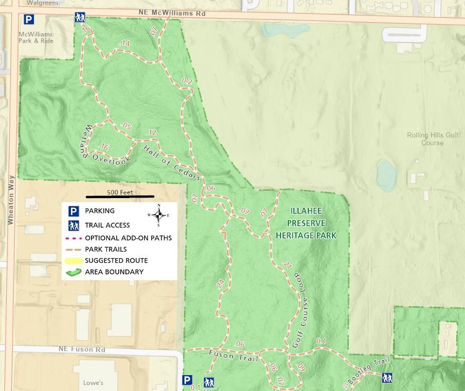
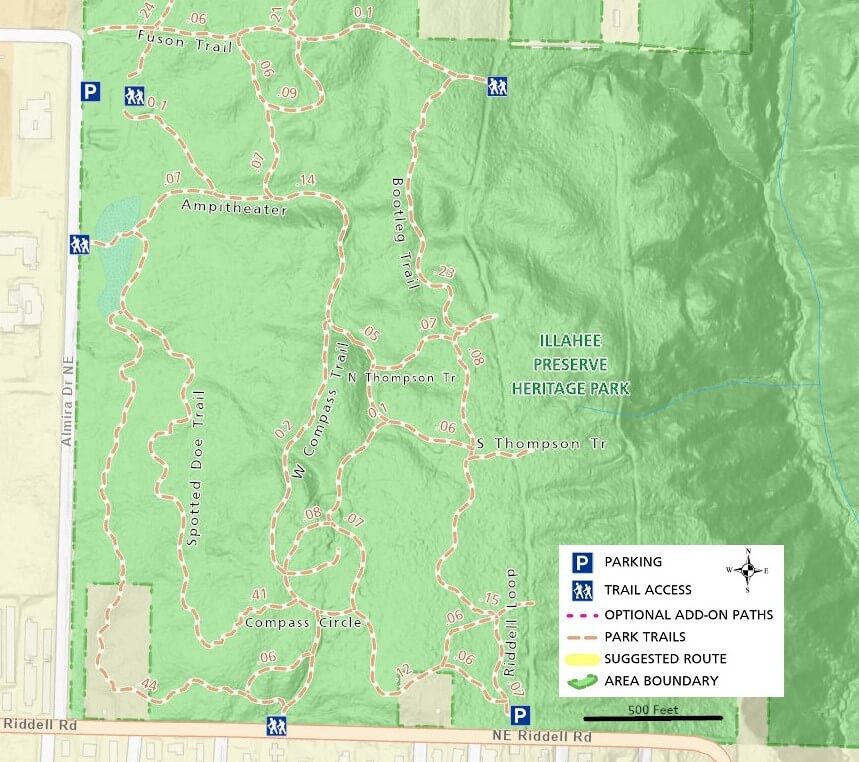
Trail access points are spread around the park’s perimeter.  The main parking area off Almira Drive is the most common entry point, but you can also park at the smaller lot off Riddell Rd or the McWilliams Park & Ride across from Walgreens and Safeway.  Other locations are walk-in only, including one at the junction of Riddell Rd and Petersville Rd.

Additional Maps

Using the left and right arrows below, browse through some additional maps of Illahee State Park and its trails

Illahee Preserve Heritage Park Trail Photos

For more information visit the authoritative Illahee Preserve Heritage Park site