N.A.D and N.A.D Marine Park Trails

A City of Bremerton Park with multiple personalities

N.A.D. Park stands for Naval Ammunition Depot and has a long history.  Created before the highway that now divides it, the park and especially a path just outside the boundary have a lot to offer.

The disc golf course will be familiar to some, but the walking path from the north end of N.A.D. Marine park provides a very scenic waterfront route that will bring you back over and over.

Pros

Cons

N.A.D Park Trail Map

The maps below shows the two separated sections of the park, the greater area, and optional trails outside of N.A.D. Marine Park.  Use arrows on either side of the map to browse the map gallery.

N.A.D. Park has some military history and may appeal to you in several ways.

If you play disc golf you have several options in Kitsap County and this is one of them.

Trails in and around the disc golf course are more developed than those through the fairgrounds course and the areas outside the course have trails as well.  Proximity to Kitsap Way and Hwy 3 is always evident by constant road noise and the upper part of the park is not big enough to allow you to escape it.  

Trails here are decent with those on the east side of Austin Dr. providing a little more variability in elevation.

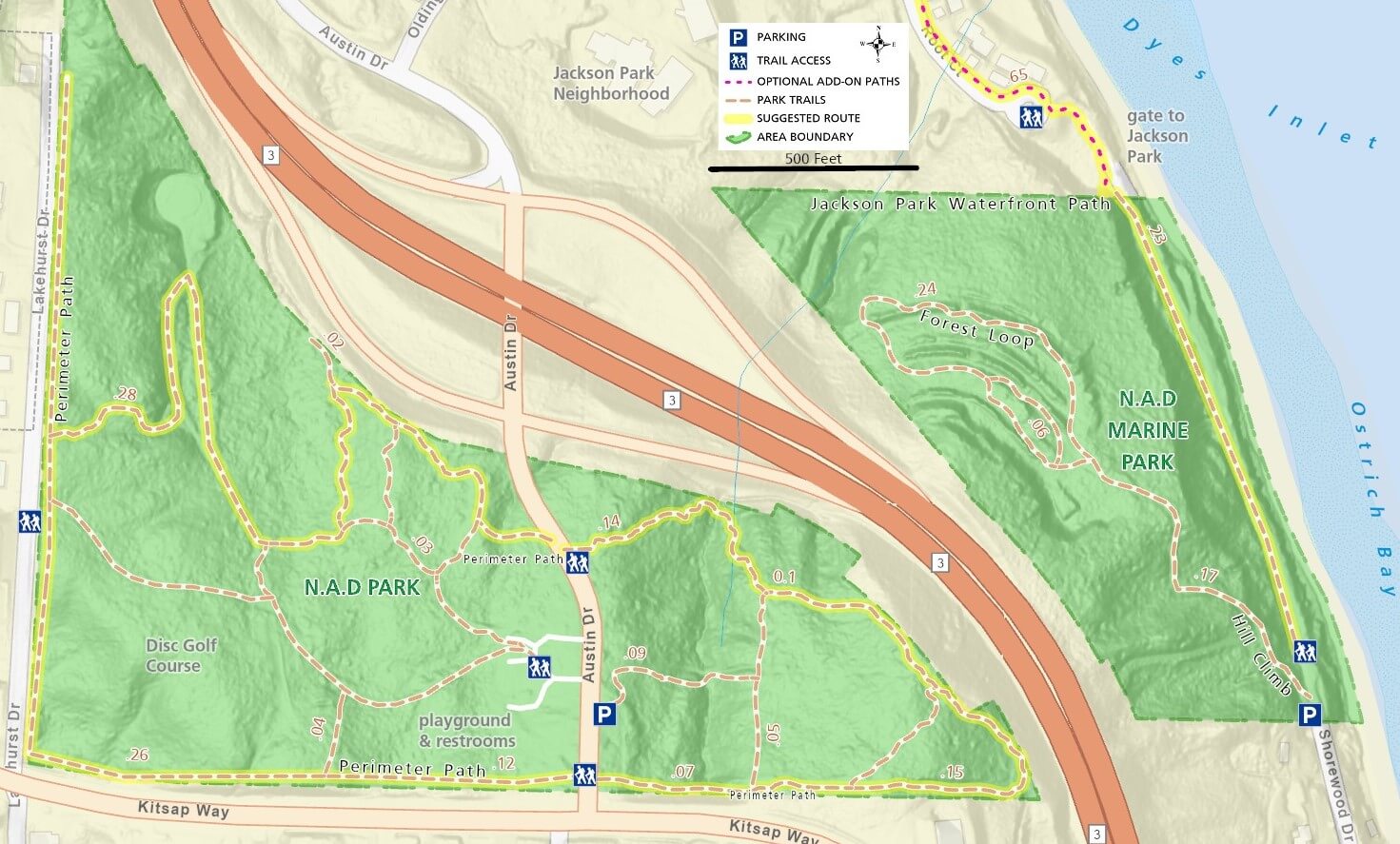
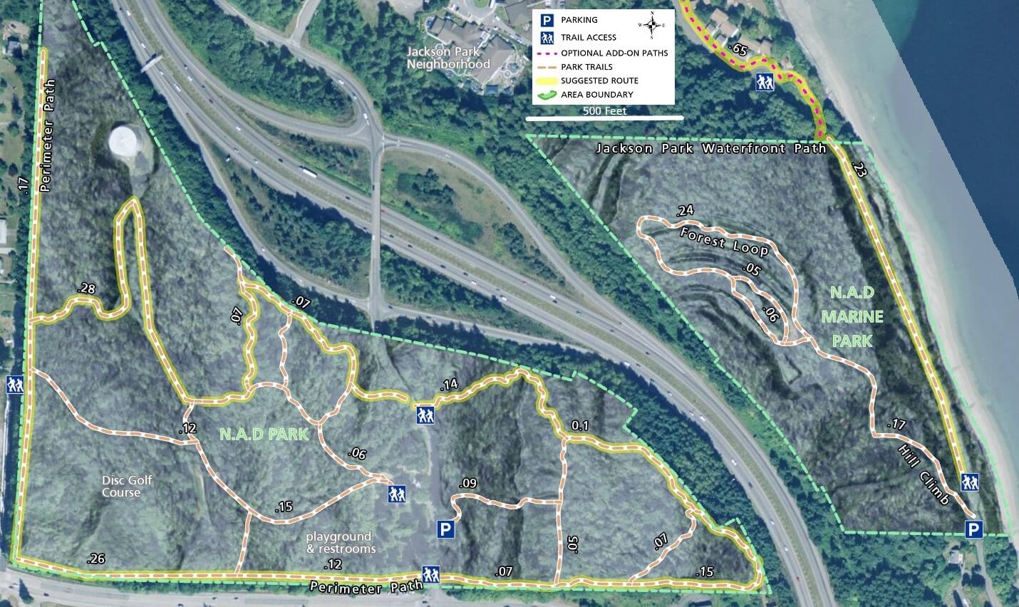
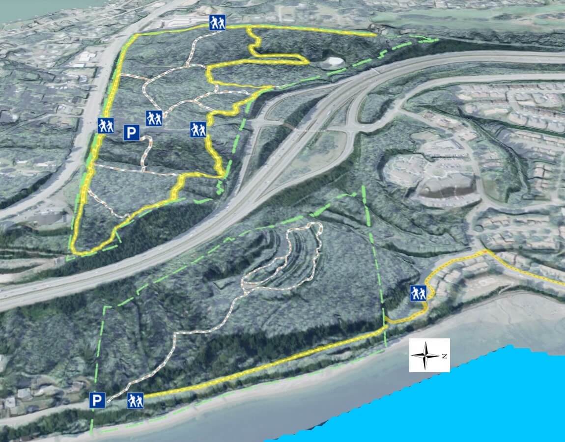
Inaccessible from the upper park, N.A.D. Marine park is the better destination, not for the park itself, but for the trail leading from its perimeter.

Access the marine park from Shorewood Dr. off Kitsap Way.  Park in the small lot at the south entrance and walk the forested path up hill to see some of the old bunkers.

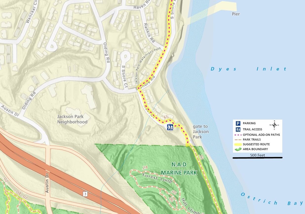
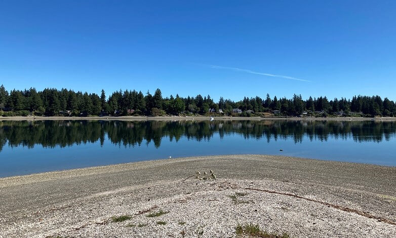
The waterfront trail is paved and level, providing access to a rocky beach and connecting to the Jackson Park neighborhood trail only about 1/4 mile from the parking area.

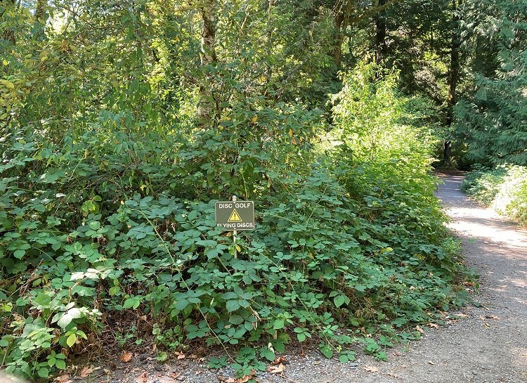
A very short unpaved trail connects the two areas.  A single sign warns that the neighborhood is Navy Property, but everyone claims that you can freely come and go. 

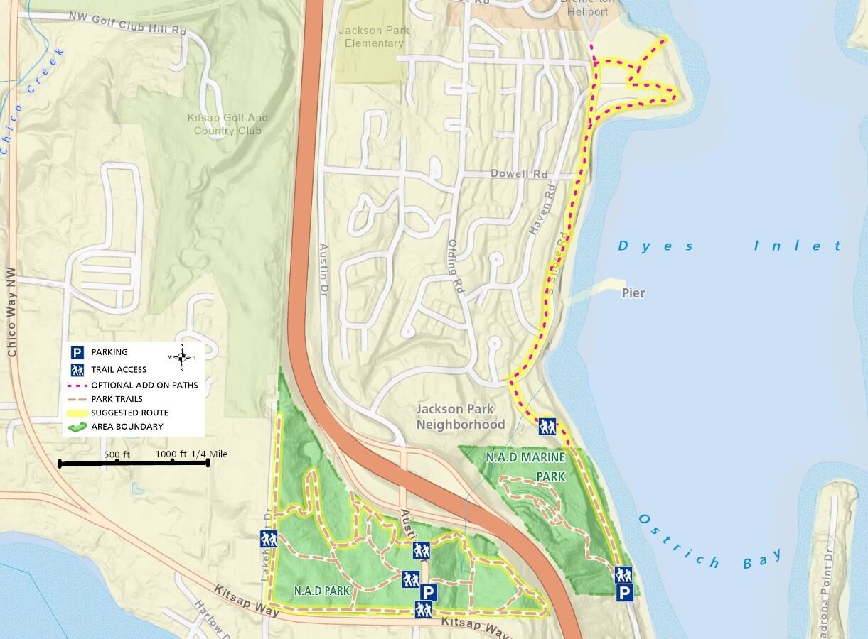
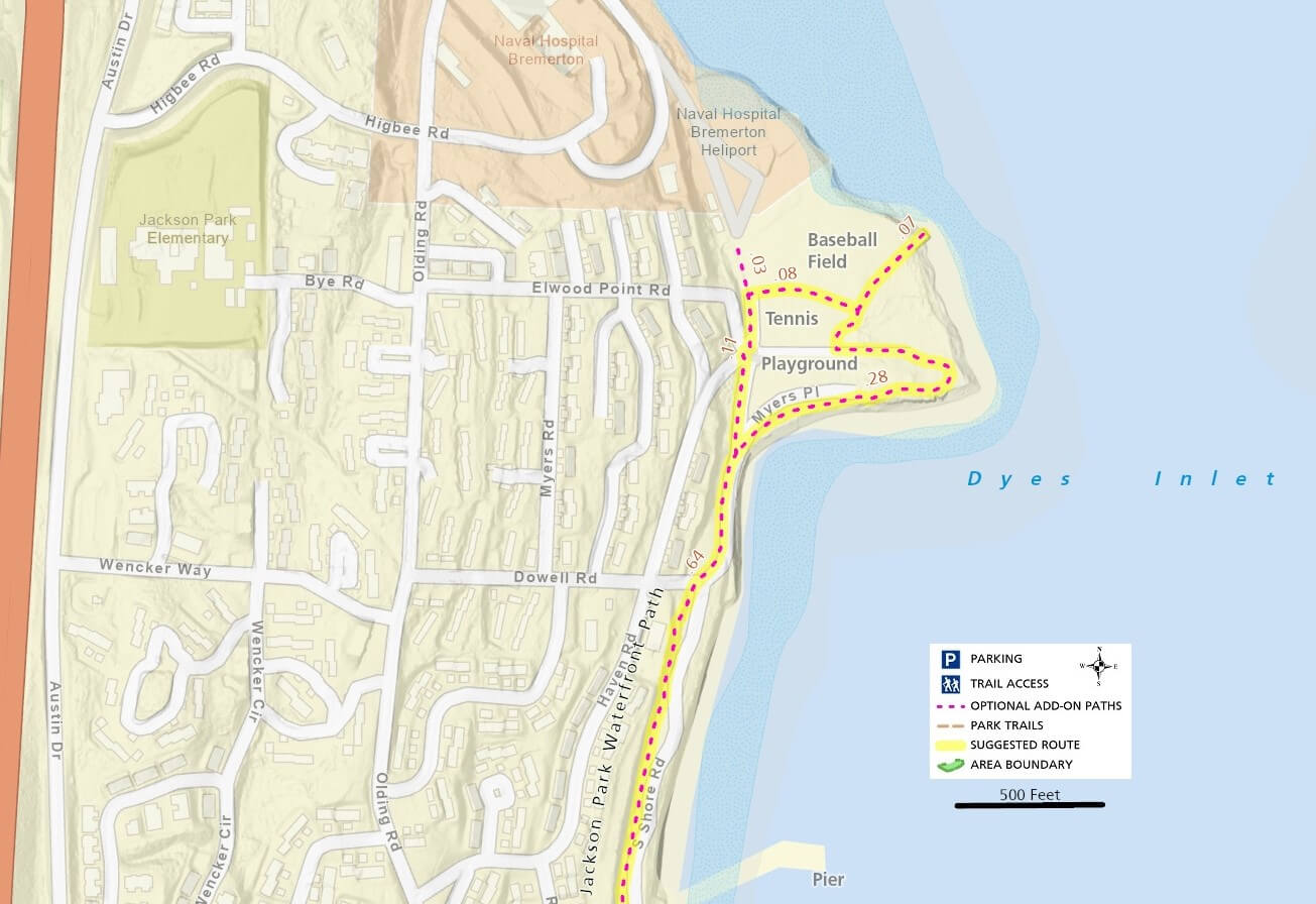
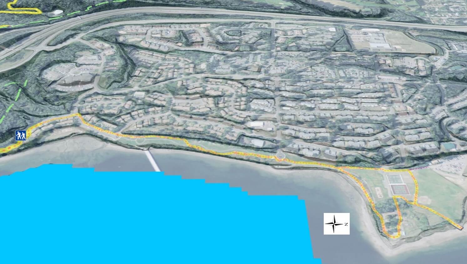
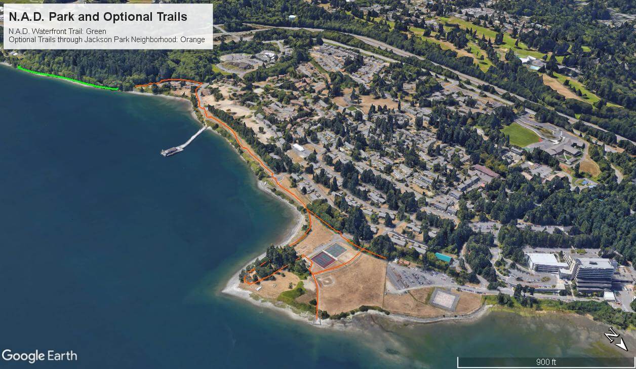
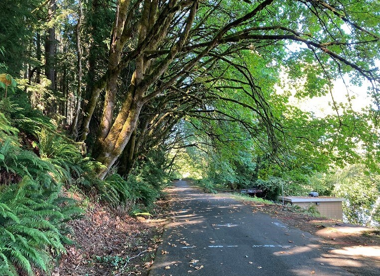
Follow the suggested route along the road and then on a dedicated paved trail with very scenic views of the water as well as distant landscapes.

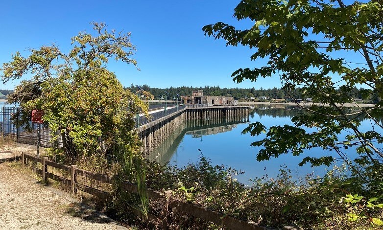
The old pier is off limits, but you have several opportunities to access the beaches along this stretch.

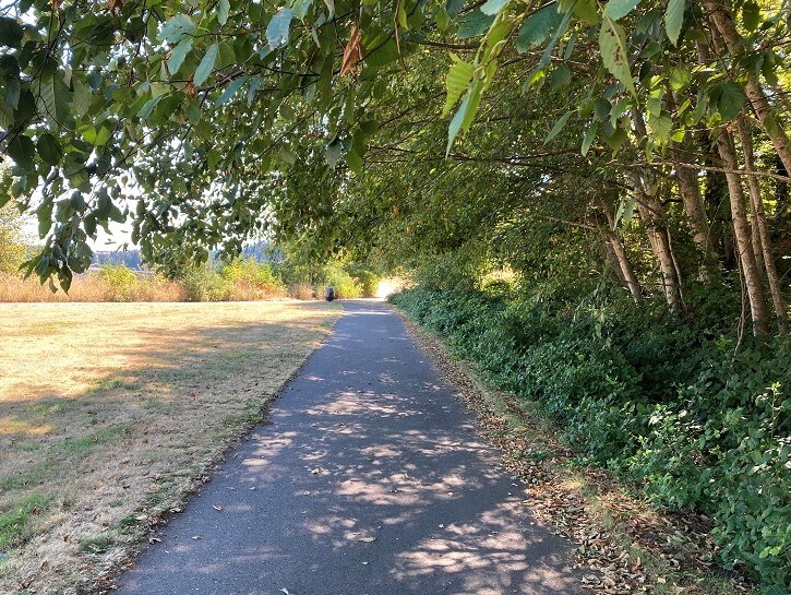
This entire area is extremely enticing on a sunny day so bring water and sunglasses and enjoy the path.  These trails are mostly paved and level making it a perfect destination for walking and biking.  as well as those pushing a stroller.

Additional Maps

The map below provides a different perspective on the park and its trails with satellite imagery and elevation hillshading.  Notice the location of several abandoned bunkers in the elevation data.

3D Maps

See the maps below for more realistic 3D perspective views of N.A.D. Park and its topography

For more information, visit the authoritative N.A.D. Park and N.A.D. Marine Park pages