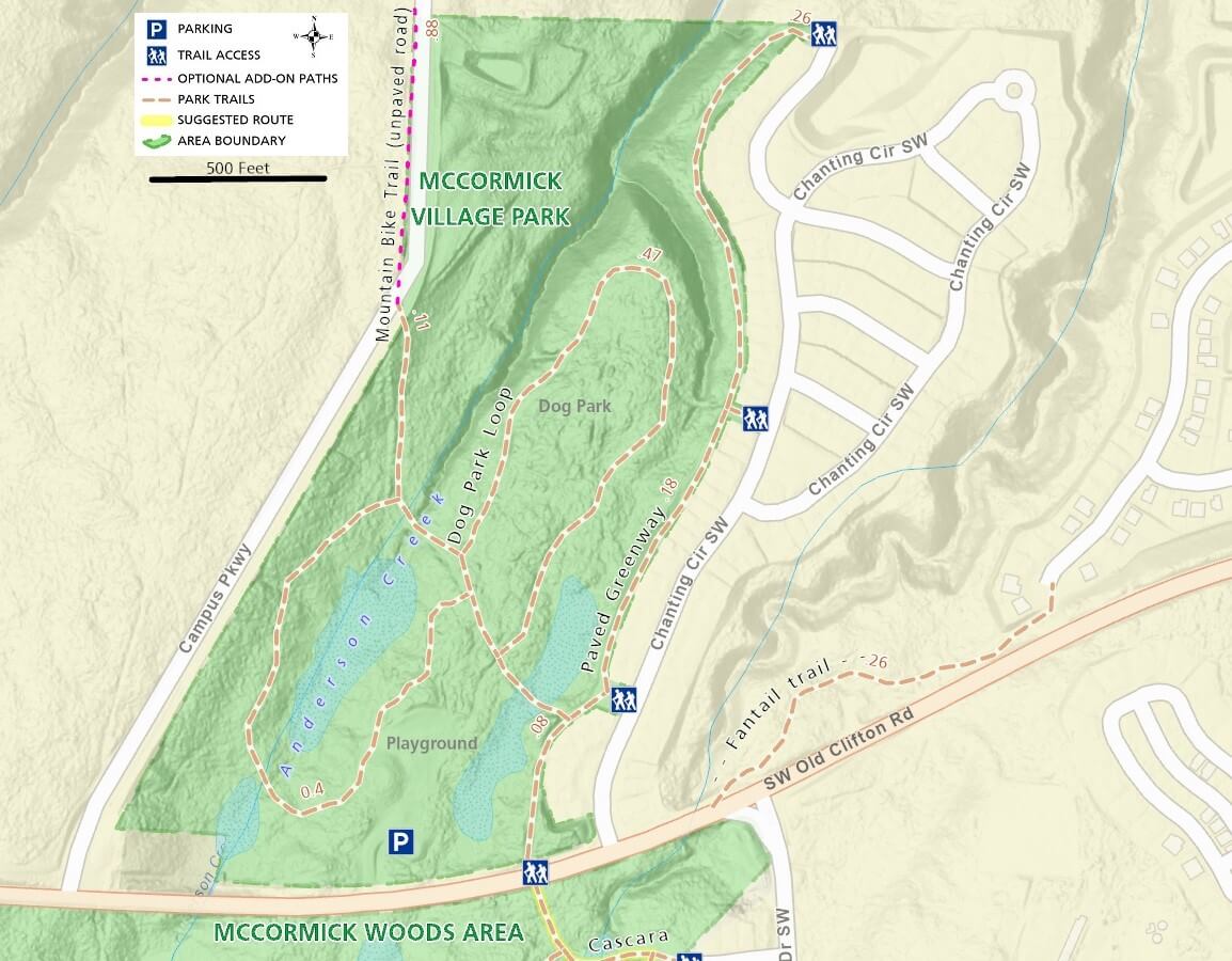
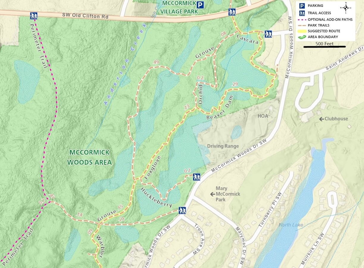
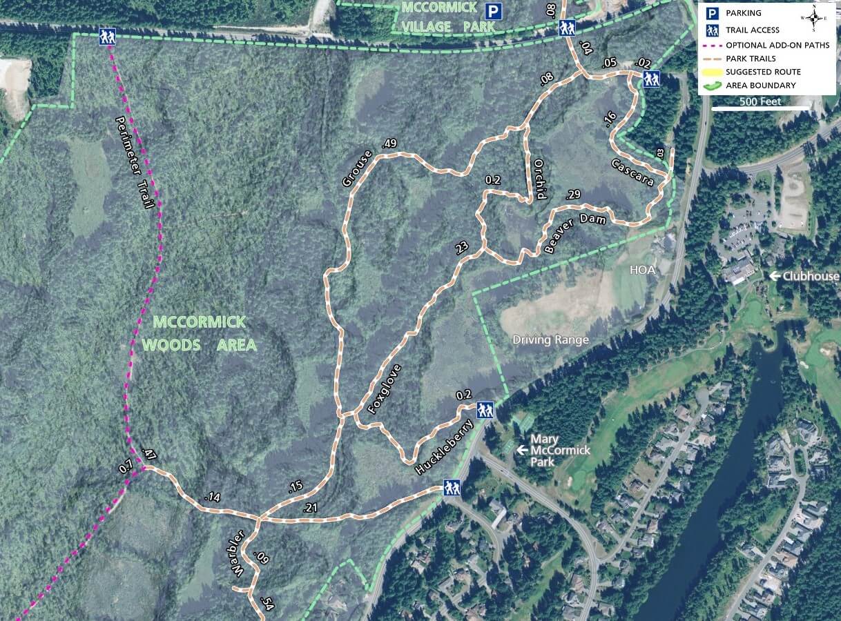
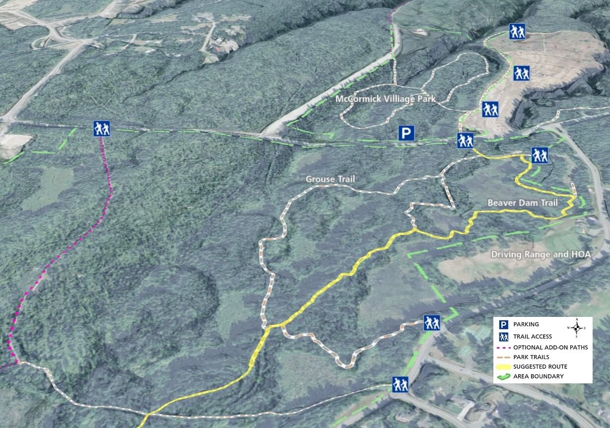
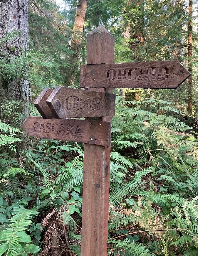
Residents in the north part of the McCormick Woods neighborhood as well as visitors entering from the Old Clifton Rd trailhead have several walking and hiking options in this northern section. Beaver Dam, Orchid, Grouse, Foxglove, and Huckleberry trails wind through through wetlands and forest with several good spots to view waterfowl. For a shorter walk, follow several of these short trails and loop back to your starting point.
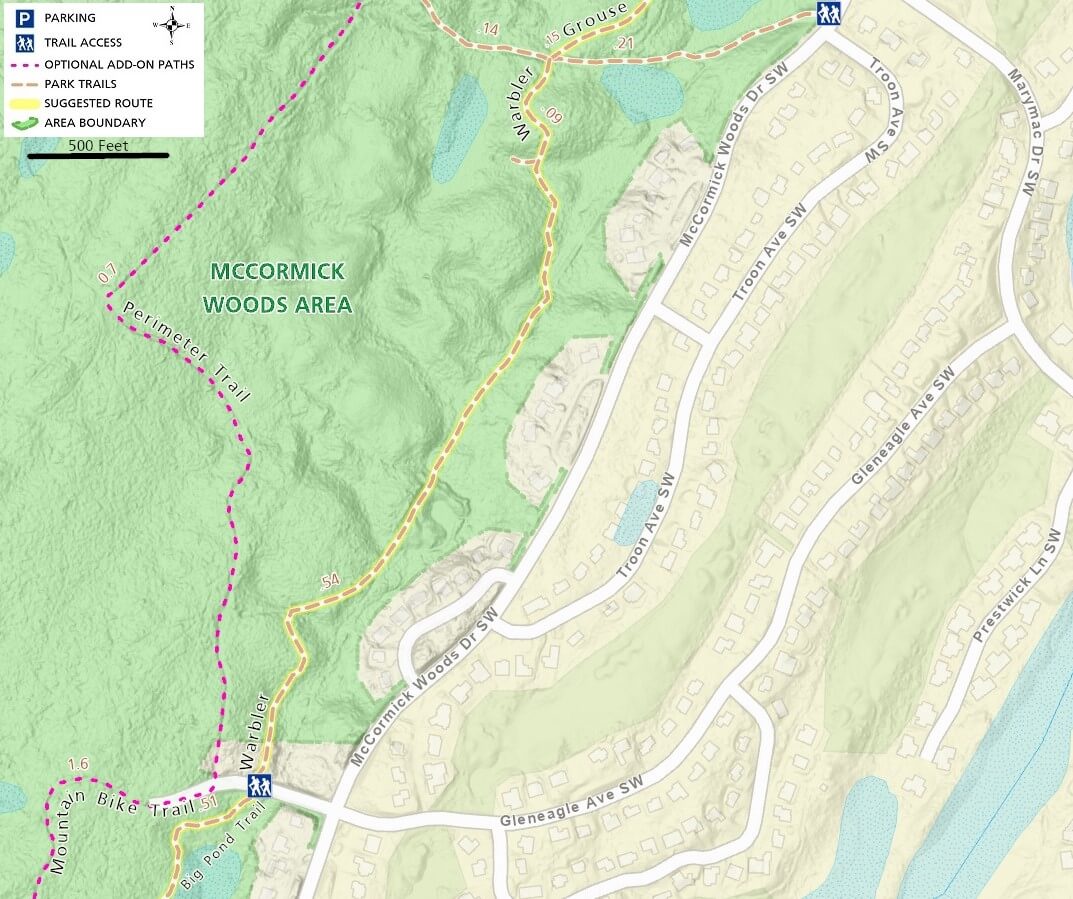
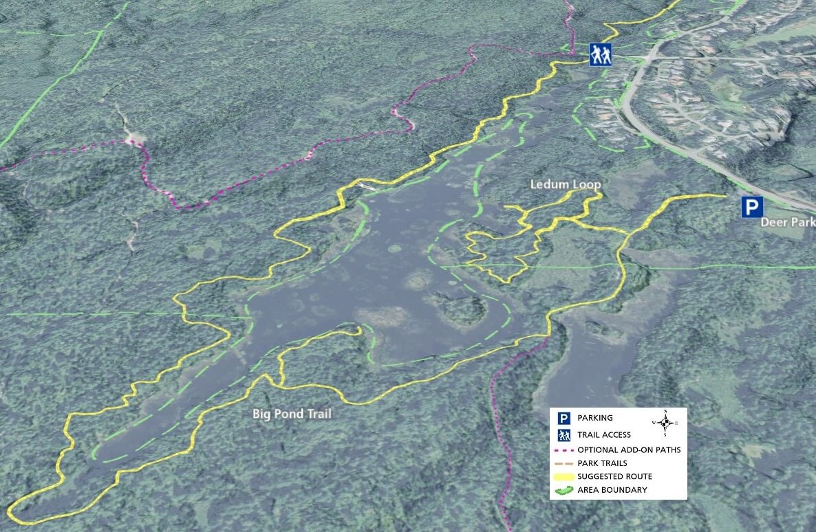
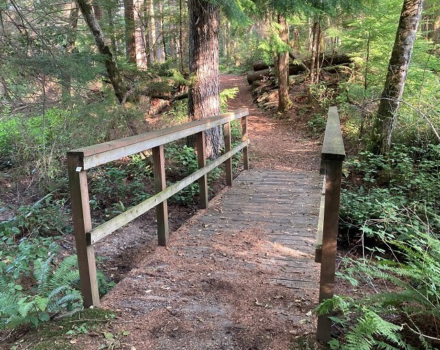
For a longer hike, continue south on the Warbler trail, which eventually turns into the Big Pond Trail, circling the largest water body along the trail. Some portions of the trail extend far from any neighborhood trailhead, limiting the number of people you will likely encounter.
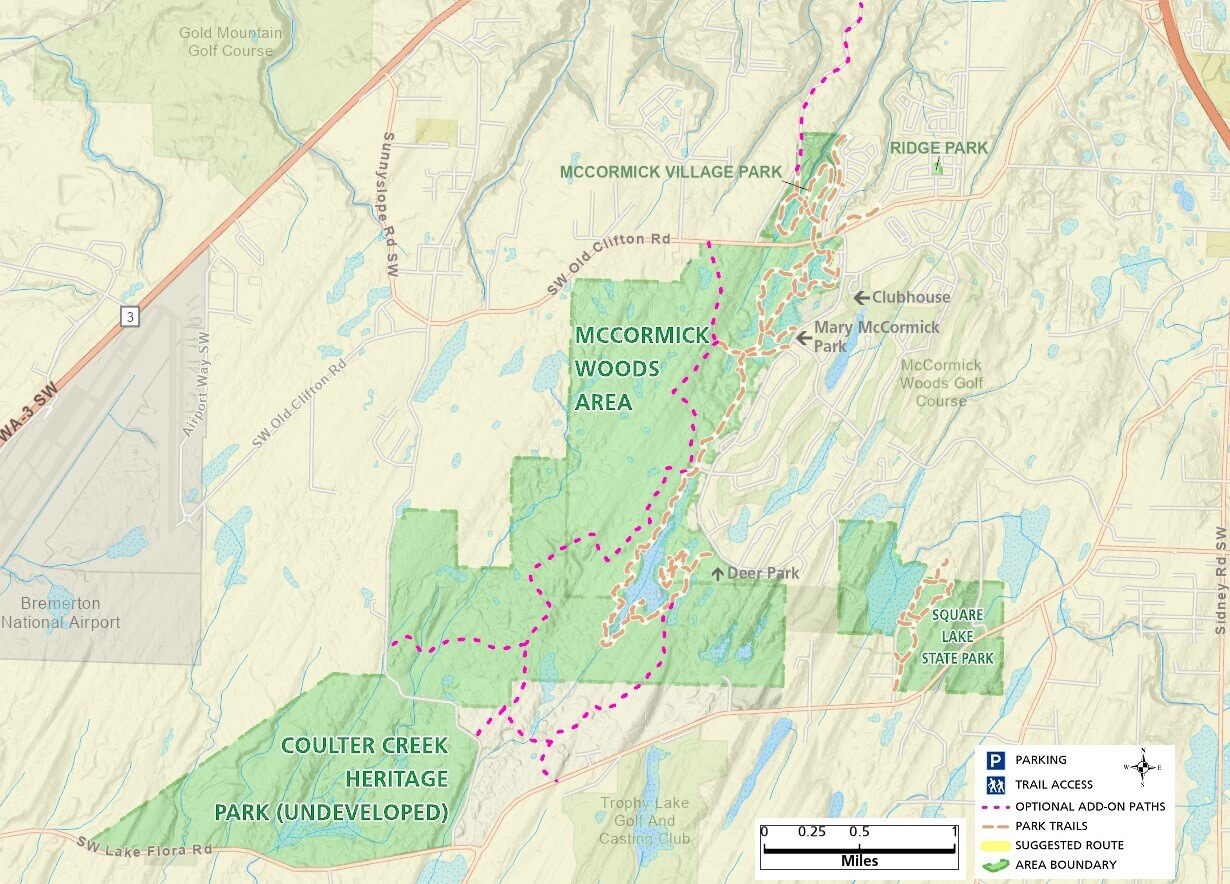
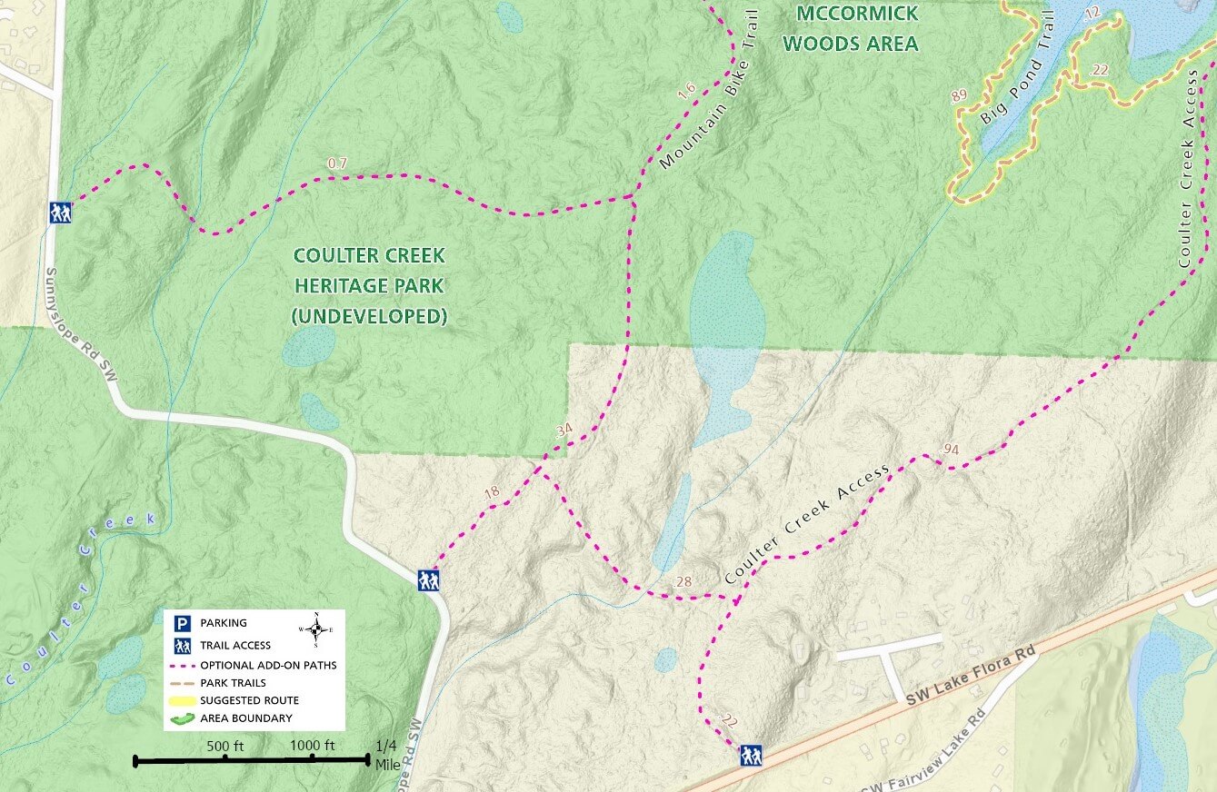
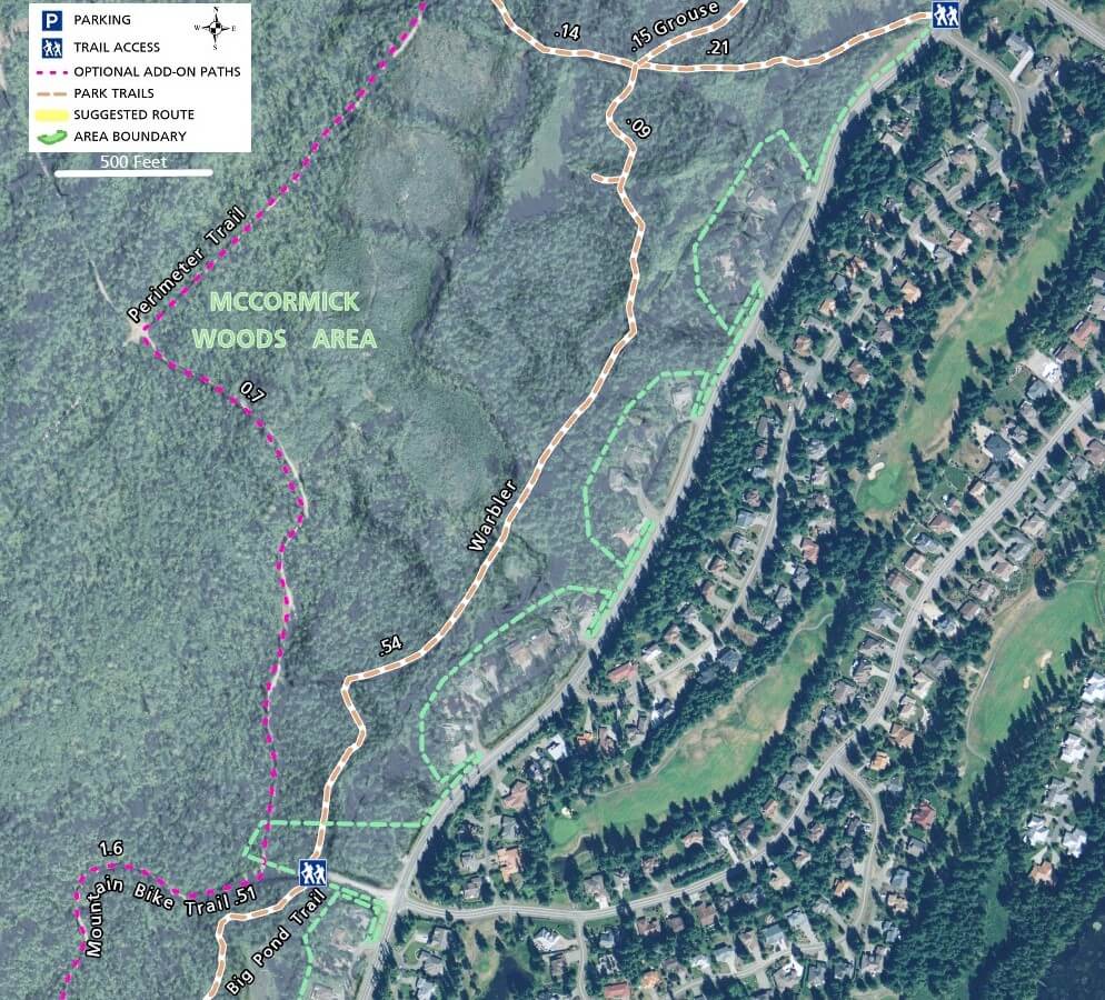
Maps of the McCormick Woods area show a set of optional trails west of and parallel to the suggested route, running to the southwest. It is unclear as to who owns and maintains these optional trails, but none of them have directional signs and they are in a more rustic state than the well-maintained McCormick Woods trails. As you head southwest on Grouse, Warbler, and Big Pond, several trail intersections allow you to head west to the optional trails, labelled Perimeter Trail and Mountain Bike Trail. These are discussed in more detail below.
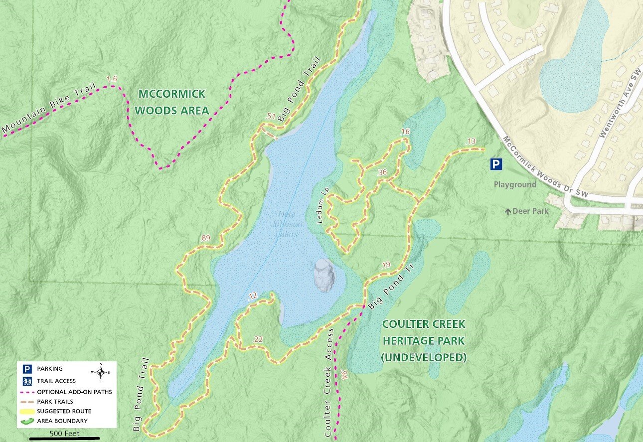
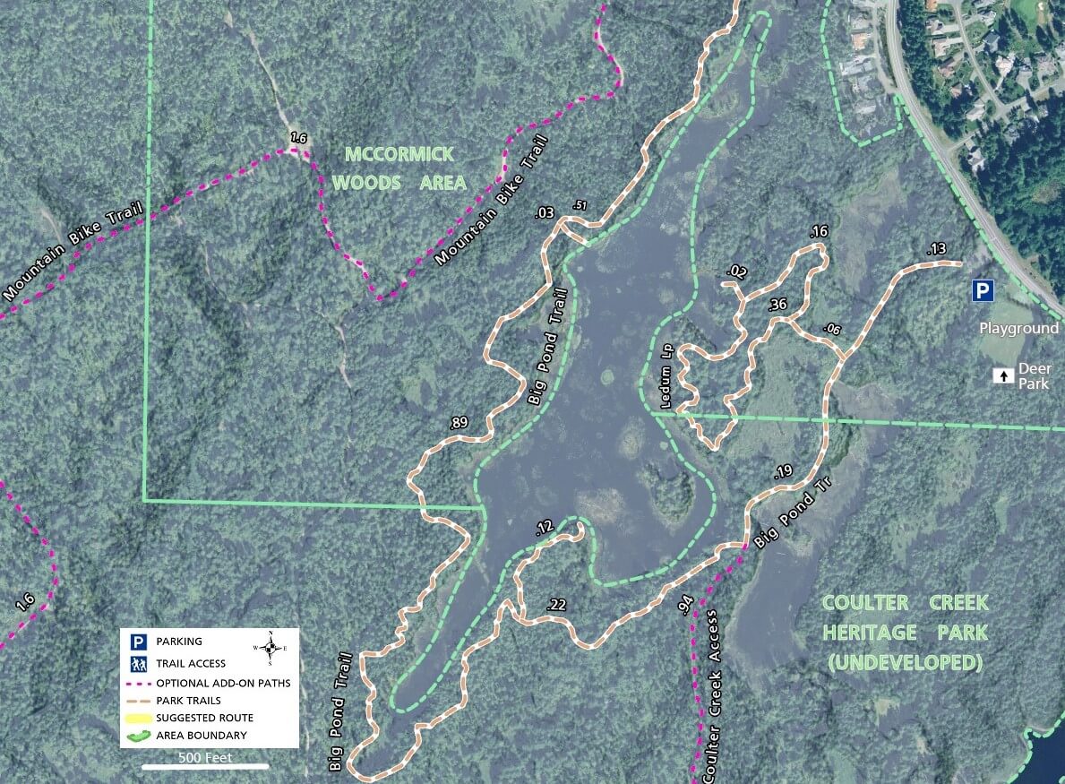
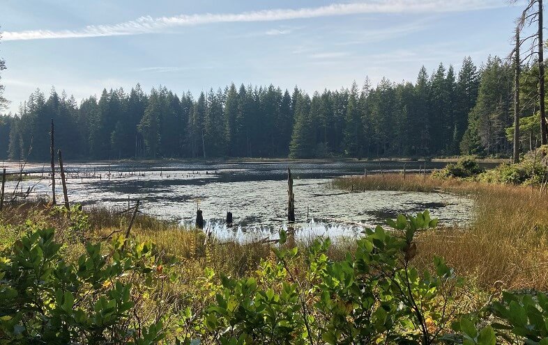
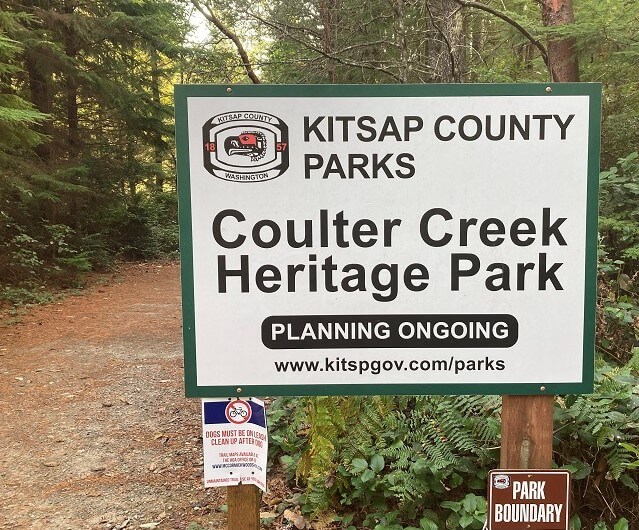
The Big Pond Trail in particular has a number of rest spots and observation points where you can look out over the lake. As you follow the Big Pond Trail south and then east and northeast around the southern end of the lake, you encounter a sign marking the boundary with the mostly undeveloped Coulter Creek Heritage Park.
The trail section leading south from this sign is the only section of the Coulter Creek trail system that is maintained at all. The rest of the purple/red optional add-on paths shown on the maps are old forest access roads and not currently maintained as trails.
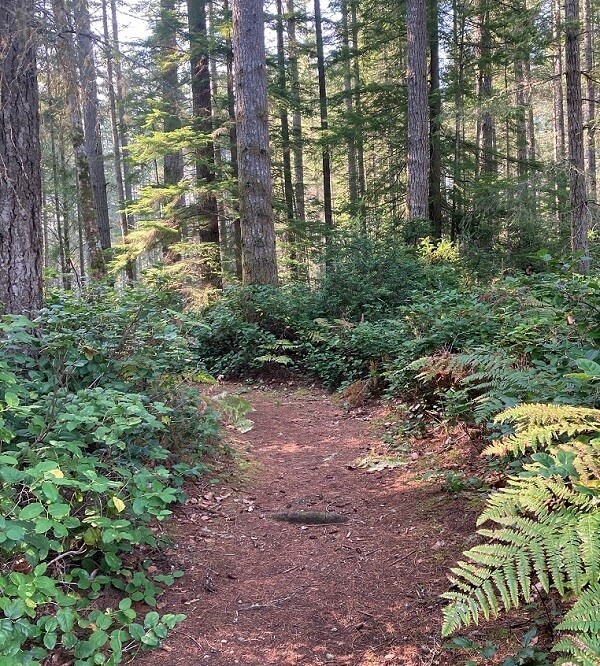
More remote and following unpaved forest roads, these optional trails are perfect for mountain biking and you will scarcely ever see anyone else as you explore this undeveloped county park.
With only a few official Coulter Creek signs, one at the Big Pond Trail intersection and the other at the Sunnyslope Rd terminus, you wont see any directional signs at trail intersections outside of the McCormick Woods area. If you follow the trail south from Big Pond to SW Lake Flora Rd you will see a private property sign marking this entrance. Until the addition of consistent signage, it is unclear if any of these trail segments are off-limits.
Resuming your hike on Big Pond Trail at the intersection with Coulter Creek, continue northeast and take the half-mile Ledum loop trail before exiting the trail at Deer Park. The parking lot here is another potential starting point for your hike and optionally, you can leave a second vehicle here for your return.
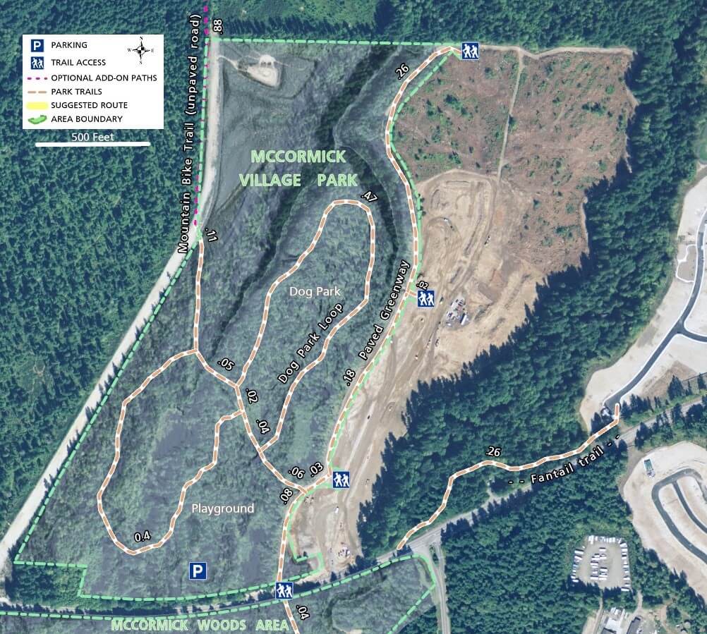
Without a second vehicle, you have two options if you started at one of the north side trailheads. Walk north on the wide shoulder of McCormick Woods Dr., retrace your steps back along the trail, or take McCormick Woods Dr. east and other connecting roads and trails back towards your car.
Each of these contrasting trail options gives you multiple ways to construct the perfect outing for you and your hiking and riding companions.