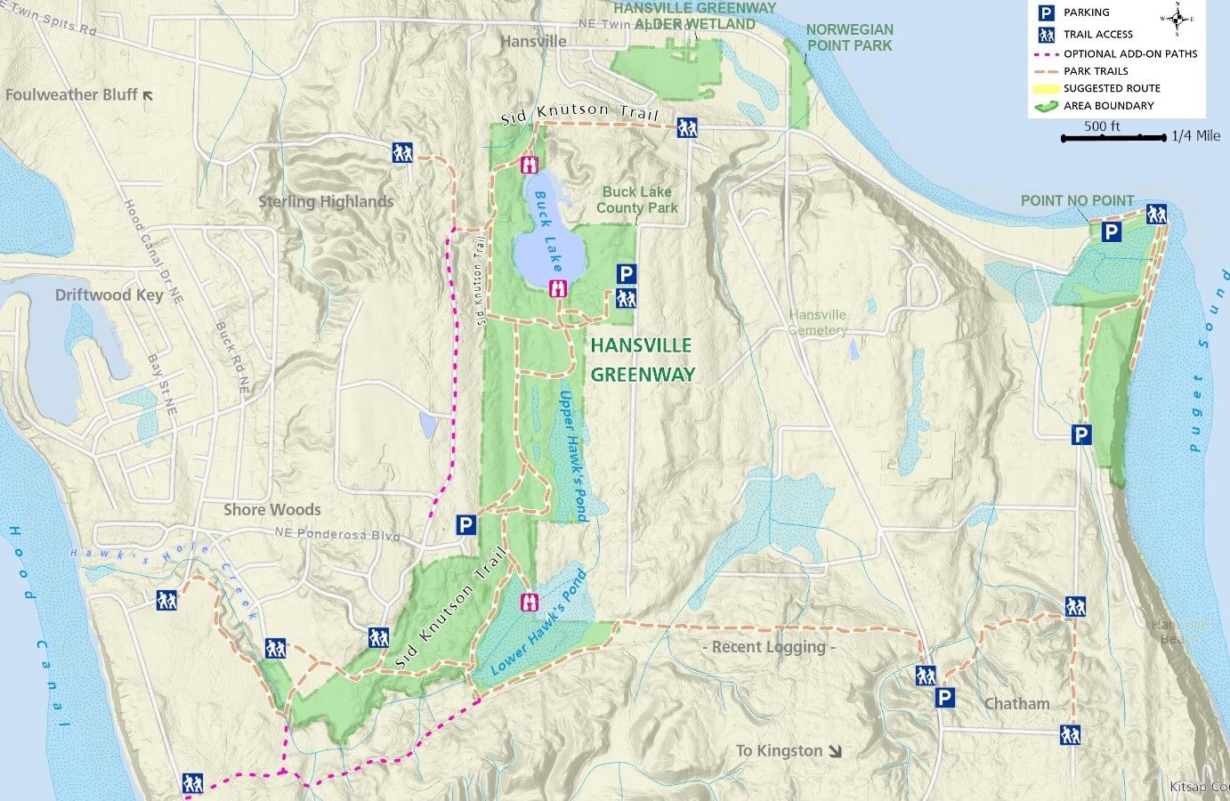
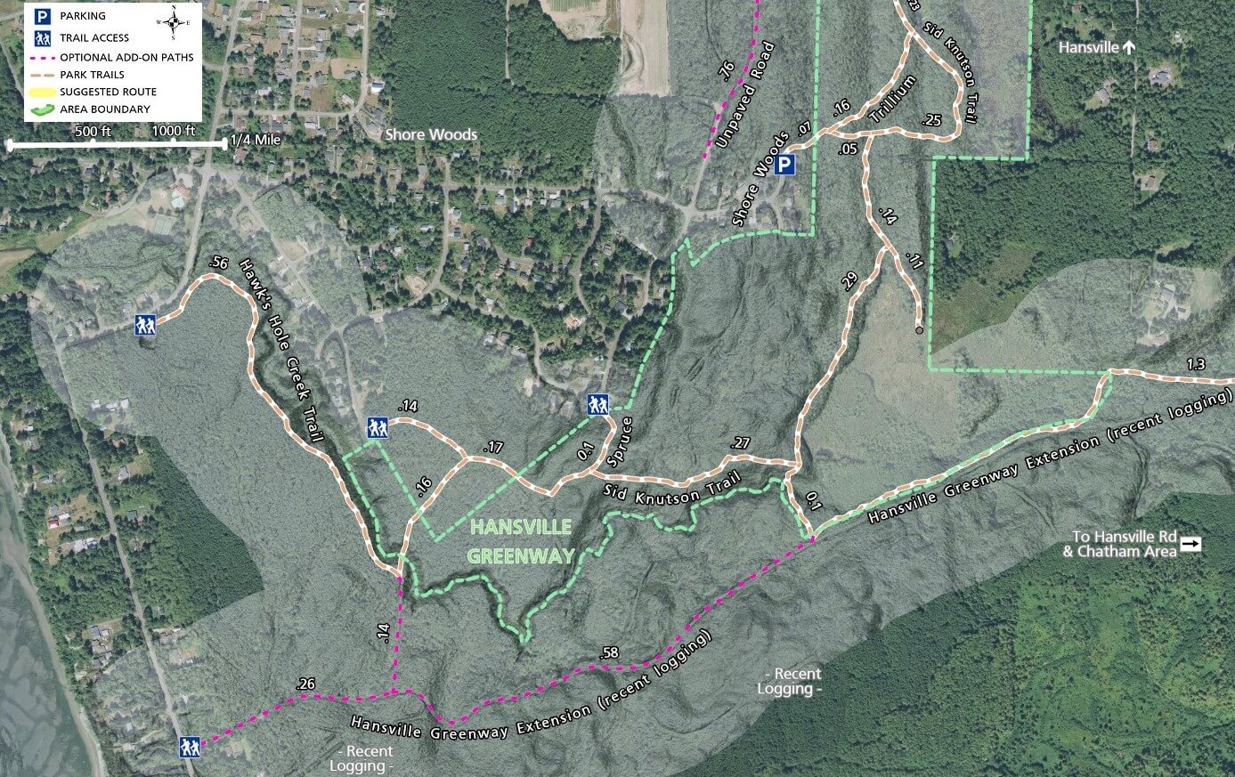
Southern and Western Trails
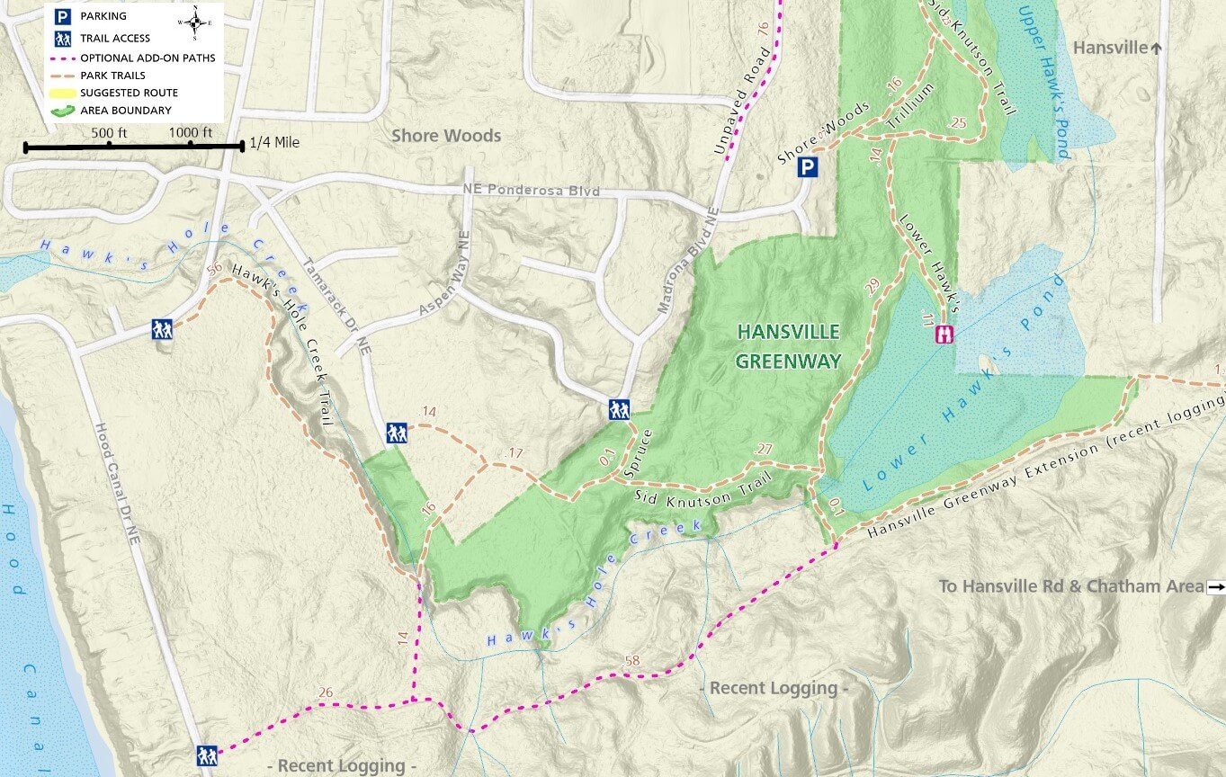
On the western end of the greenway, the Hawks Hole Creek Trail starts (or ends) at the trailhead on Hood Canal Dr. NE, and winds through a recently cut forest. Trail segments outside the greenway boundaries cross or run alongside privately owned land, and often results in much lower quality forest cover. This section will be more appealing to mountain bikers who can expect to be alone on the trail.
An intersection with a trail to the right will give the option of turning and riding on logging roads through the recently cut areas to the south (shown in red on the map). This area may be appealing to mountain bikers, but you won’t find a single tree standing here. The aerial photos shown on some of the maps show these areas as forest, but they are no longer accurate. Staying on the greenway trail heading east, you will encounter several spurs connecting to roads in the Shore Woods neighborhood and eventually a signed intersection will prompt you to head north towards Hansville and Buck Lake or turn south and then east towards Chatham.
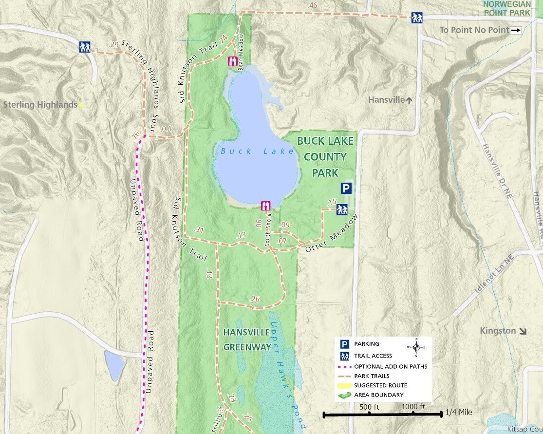
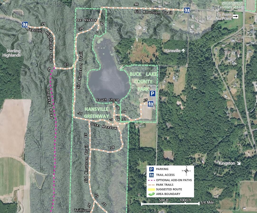
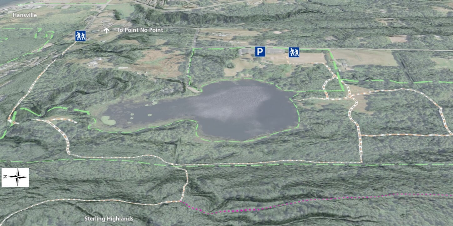
Upper Shore Woods, Buck Lake and Chatham Highlands Trails
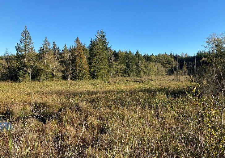
Head north through the most mature forest found in the greenway and visit the multiple wetland areas and overlooks that dot the higher spots around several marshes.
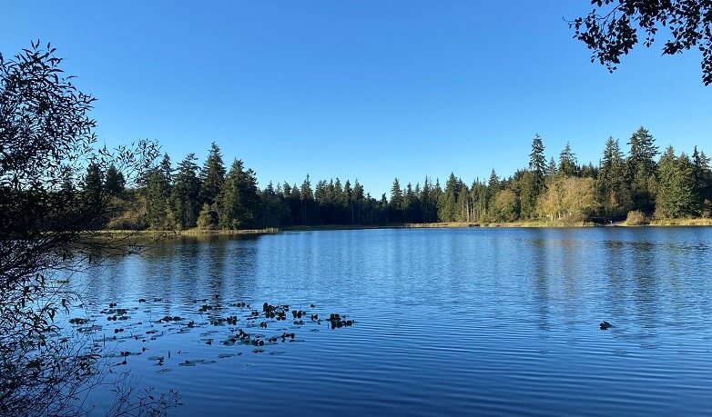
The section just north of the Ponderosa Blvd. trailhead and west of Upper Hawk’s Pond, is dominated by tall dense tree cover and can get very dark, even on a sunny day. Bikers can continue north past Buck Lake to the end of the trail and follow paved roads east to Point No Point Park.
West of Buck Lake and outside of the greenway property, a trail spur connects to the Sterling Highlands area or optionally heads south along an unpaved road, more enjoyable as a mountain bike route.
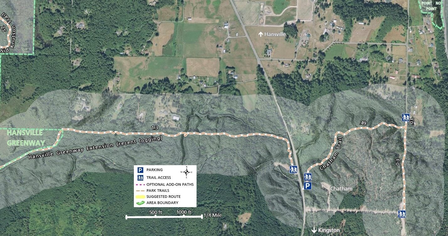
Southern and Eastern Trails, including Chatham
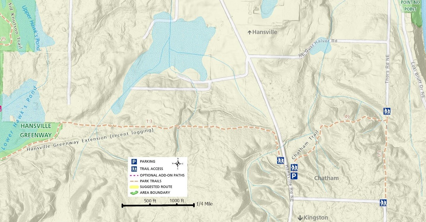
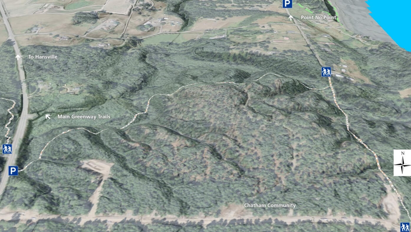
Optionally, and especially if on a mountain bike, take the trail east towards Hansville Rd and Chatham, labelled Hansville Greenway Extension (recent logging) on the maps here. Almost the entire stretch of trail to Hansville Rd is along the edge of the recently cut area, but does provide some nice challenges for mountain bikers. The end of this section turns south before ending at Hansville Rd and has very tight turns around tree stumps.
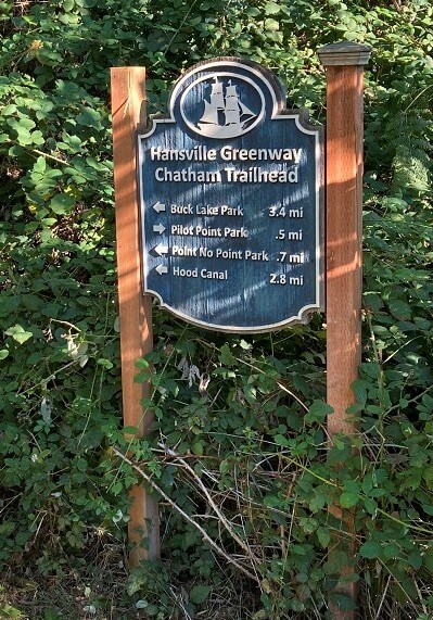
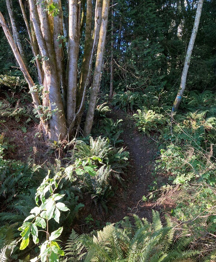
On the other side of Hansville Rd, the shoulder is wide enough that you can easily park here if you choose to start or end your ride or hike here. The Chatham Trail, part of the greenway system, climbs and descends hills through continuous forest and loops south before ending in the Chatham neighborhood. Walk or ride the short stretch of road back to Hansville Rd or retrace your route back along the trail. Unlike other trail sections, the Chatham trail can be very narrow and is not optimal for mountain biking.
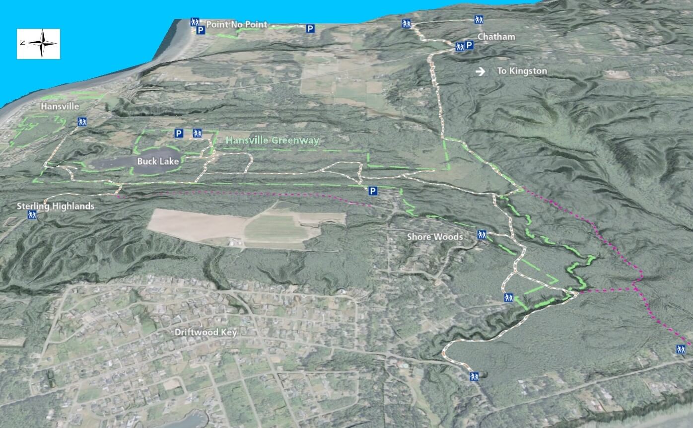
In summary, hikers will most likely walk only a part of the Hansville Greenway Trail network, whereas mountain bikers can start somewhere in the middle or at either end and ride the entire trail.