Green MountainTrails

A popular trail network in Kitsap County’s ‘Mountains’

When you feel like hiking up mountain trails to scenic vistas, Green Mountain is a perfect destination.

A variety of trails climb through mature forest, cross unpaved access roads, and skirt clear-cut areas.

Trails in this multi-use state forest are shared by hikers, bikers, equestrians, and motorcyclists

Pros

Cons

Green Mountain State Forest Trail Maps

The map series begins with an overview map of the entire Green Mountain trail network.  Detailed trail maps follow, highlighting popular destinations and trails.  Use the arrows beside each map to view the complete series.  Maps are optimized for easy on-screen viewing without the need for magnification on large screens.  Optionally, click to view and/or save a full-size map of the entire Green Mountain State Forest and its trails.

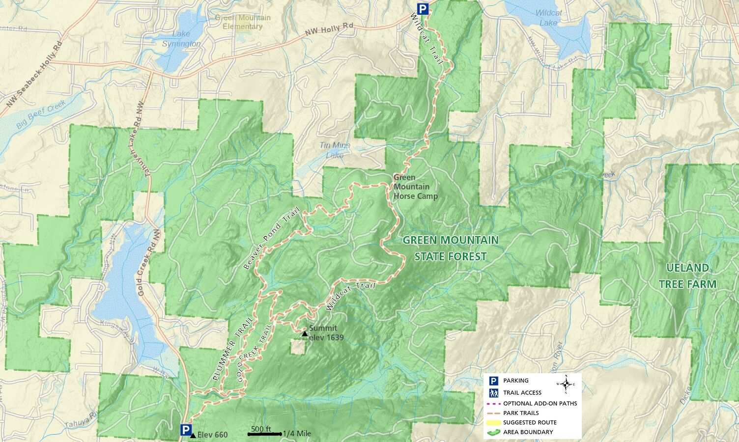
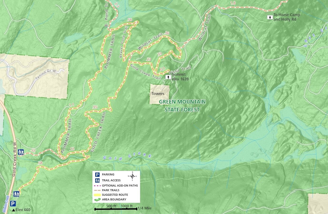
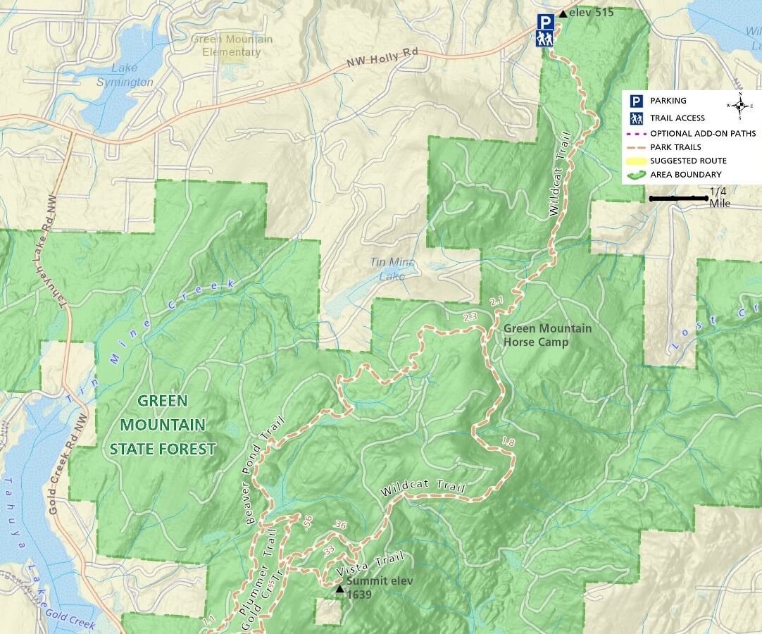
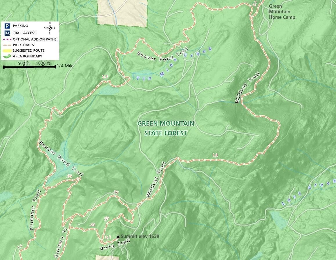
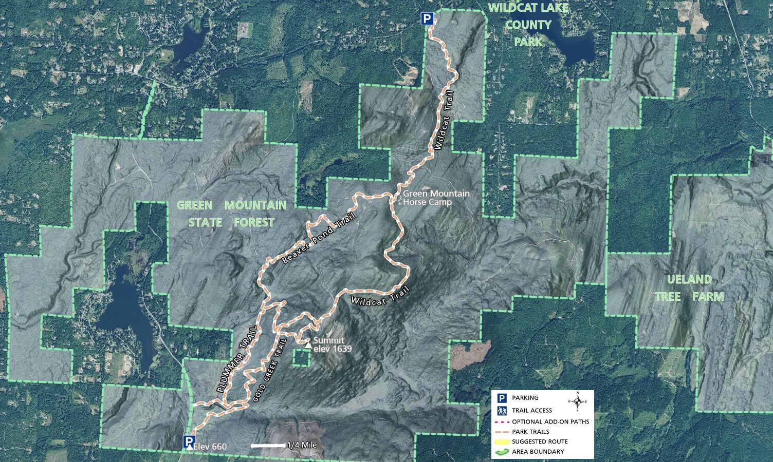
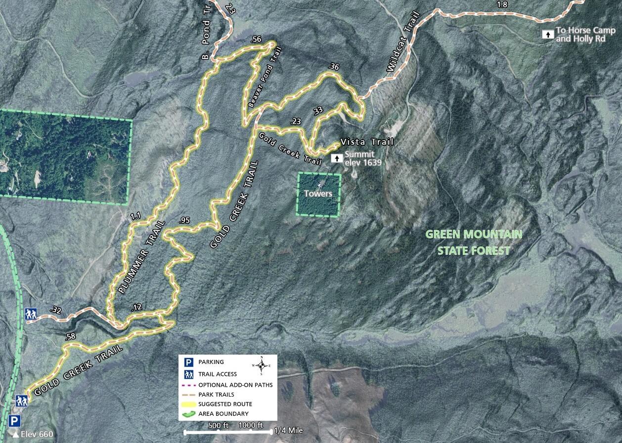
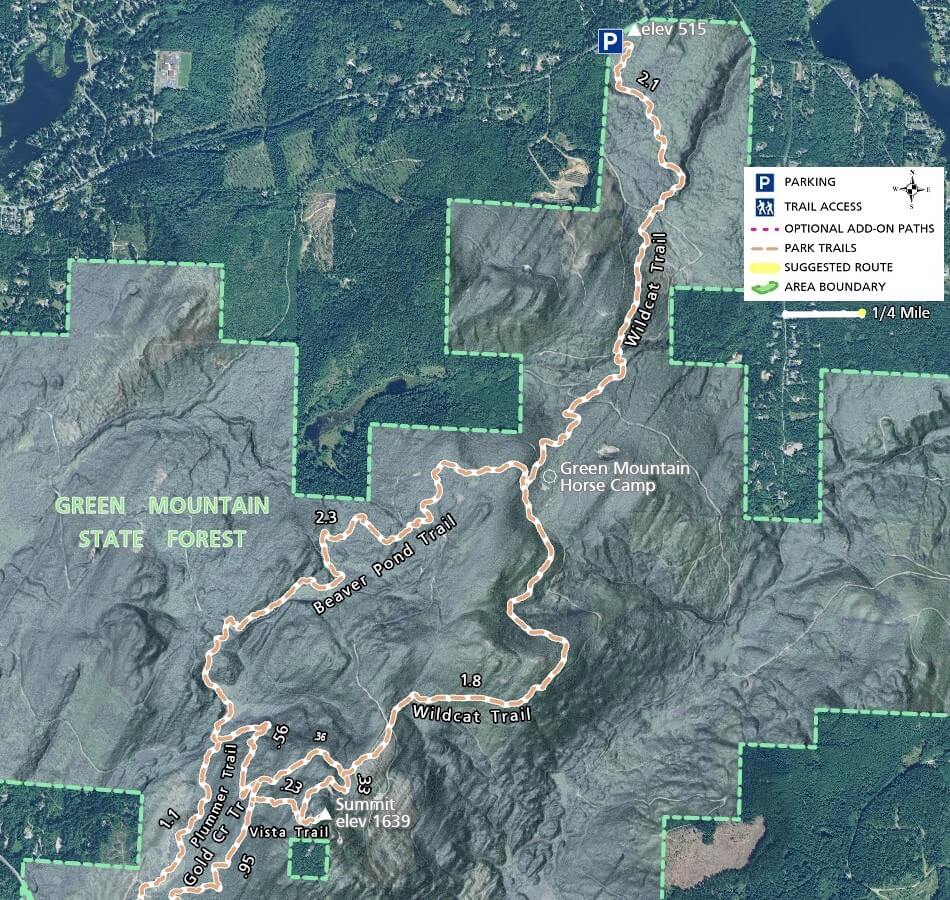
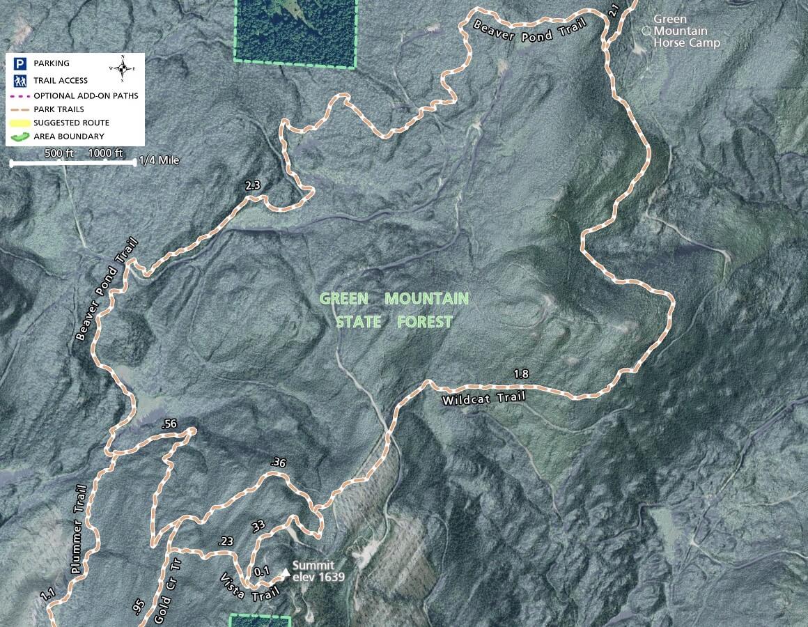
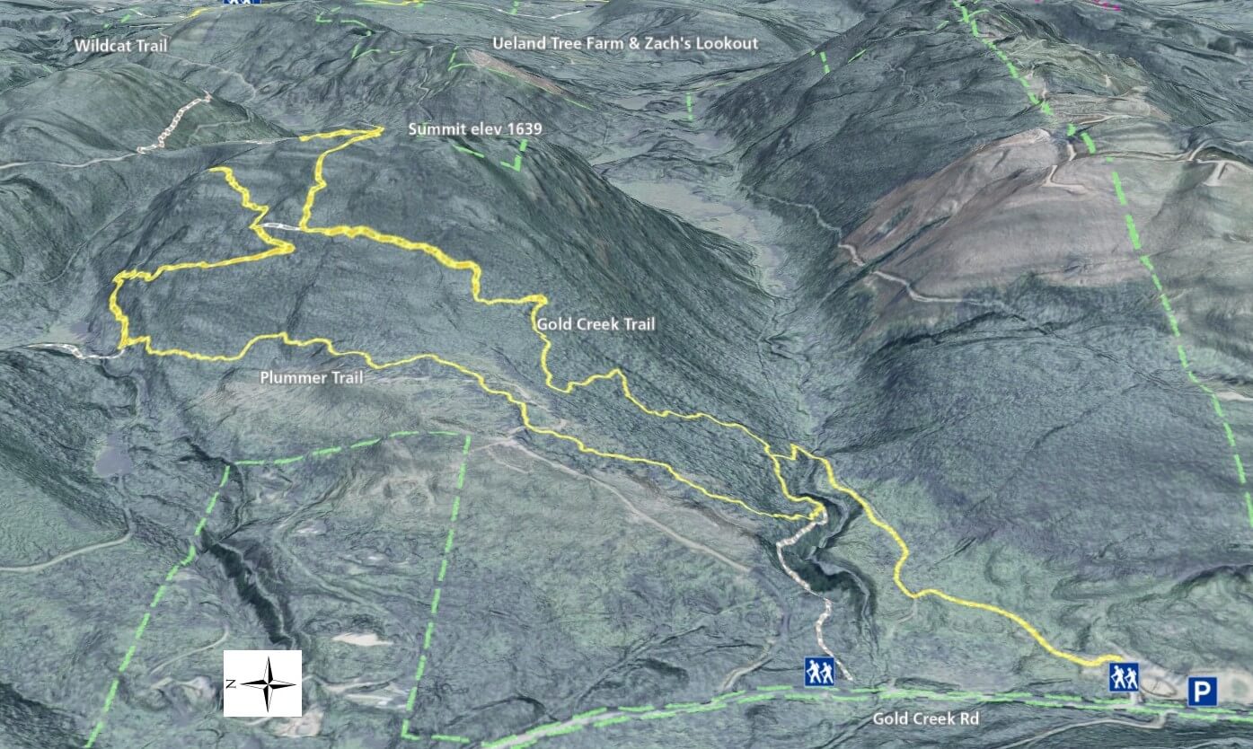
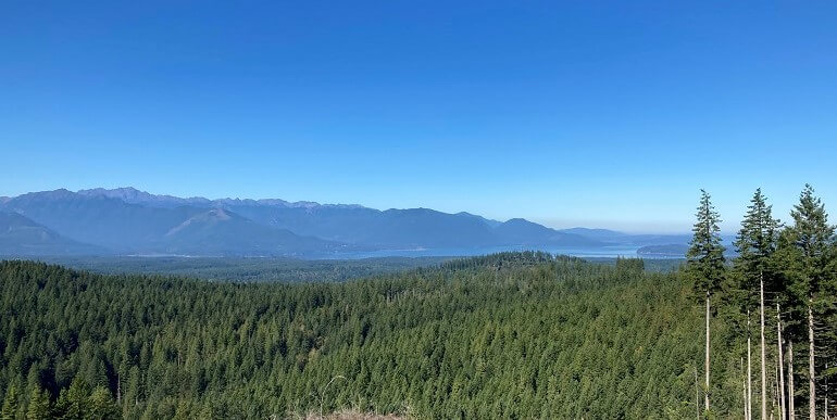
A hiking trip up the side of a mountain to a panoramic viewpoint is very appealing to many of us, but Kitsap County doesn’t have much in the mountain category.  Green Mountain State Forest is the one local destination where this need can be satisfied.  Sure, you can drive further to mountains in the Olympics or even the Cascades, but if you prefer to take a short drive to Kitsap County’s highest publicly accessible point, Green Mountain is for you.

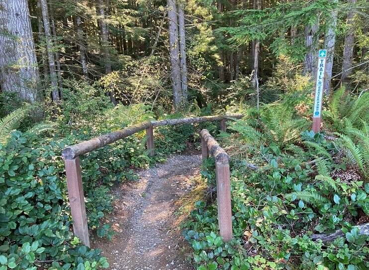
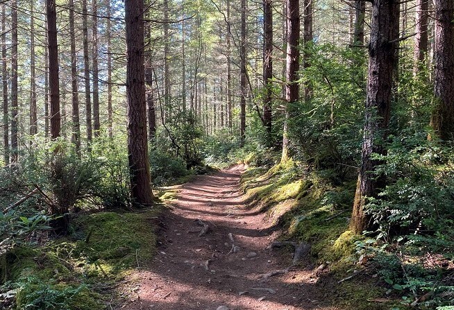
As a working state forest, Green Mountain’s trails are provided for hiking, mountain biking, horseback riding, and dirt bike riding while simultaneously being used for timber production and other activities.

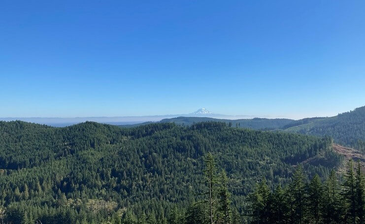
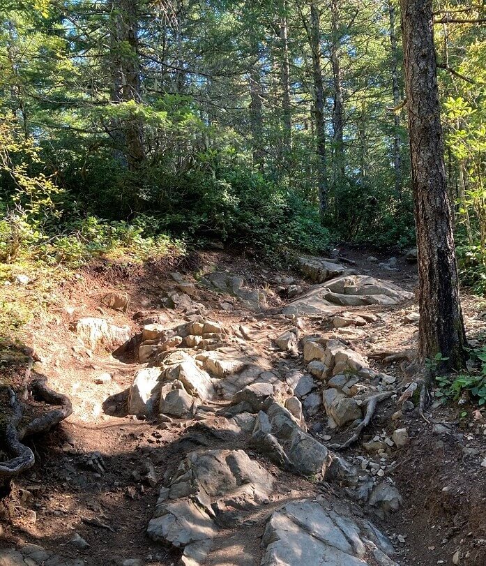
Some may find the effects of active or recent timber harvesting to be an eyesore, while others appreciate the complex network of unpaved forest access roads and scenic vistas created as a by-product of those activities.

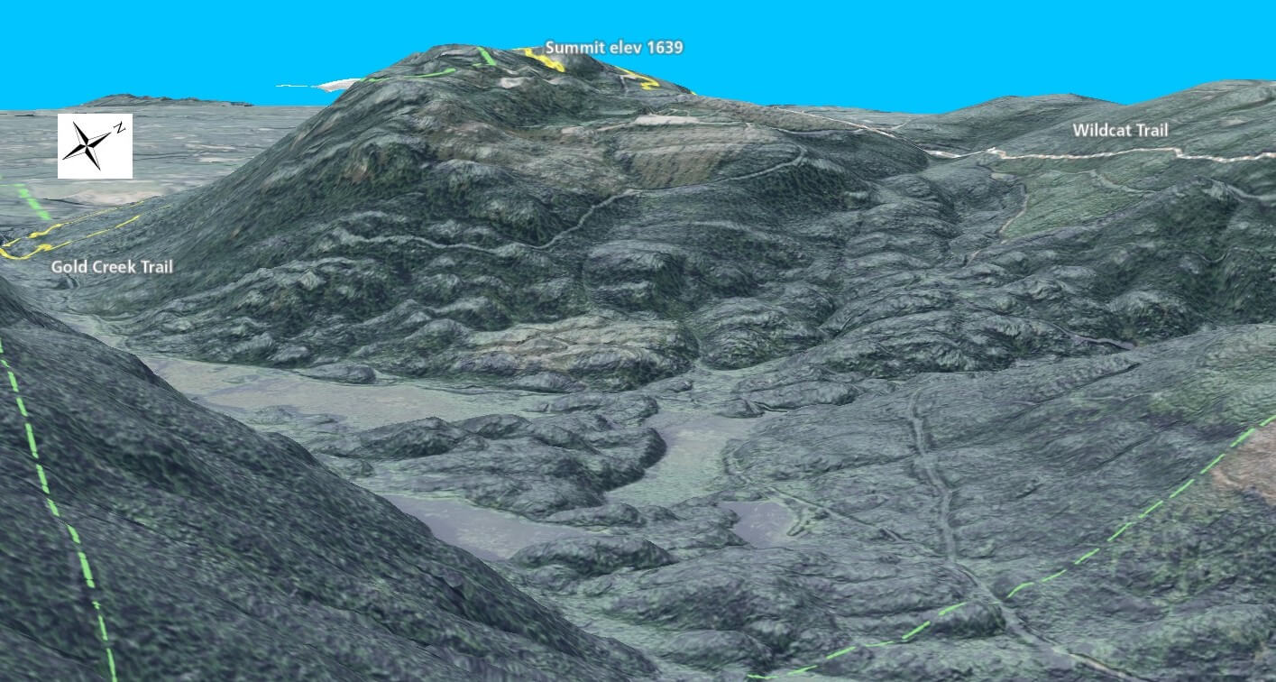
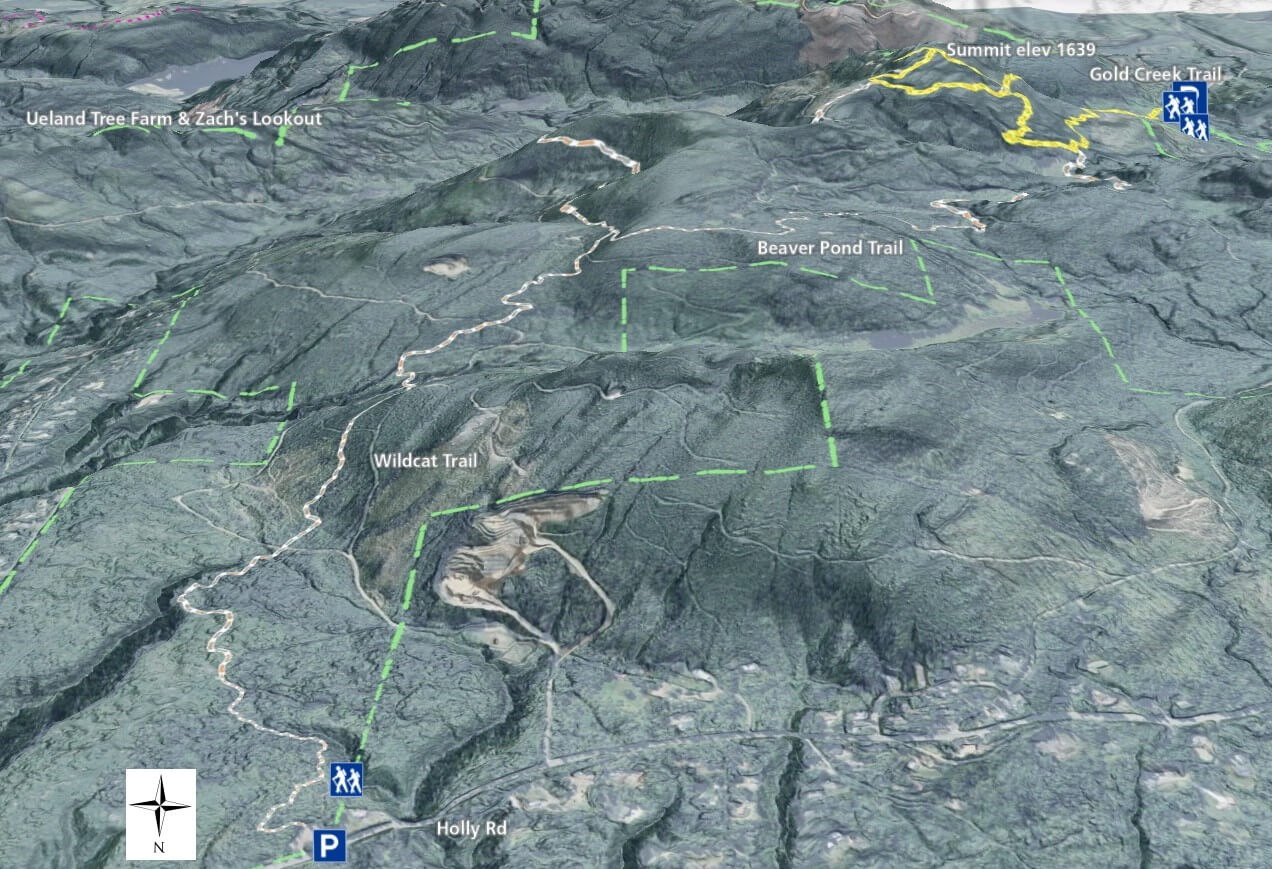
Several trails north of the summit cross through clearcut areas, but do offer amazing views towards the Olympics as well as Seattle and the Cascades.

Officially, Green Mountain State Forest has 16 miles of trails, but in reality, multiple unnamed trails in addition to the many unpaved roads, provide even more options to create your own route.

The majority of hikers park on the southeast side of the forest in the parking area off Gold Creek Rd NW, because the shortest route to the summit is just under 2 miles long.  The suggested route is a loop of almost 4-1/2 miles including sections of Gold Creek Trail, Vista Trail, Beaver Pond Trail, and Plummer Trail.

For those who prefer a longer path with more gradual elevation gain can park at the Wildcat trailhead on NW Holly Rd and take an approximately 7-1/2 mile loop with a stop at the summit.  Dirt bikes are allowed on the Wildcat trail, but you can hear them coming so prepare to step aside and allow them pass if necessary.  

Additional Maps

The maps below provide a different perspective on the Green Mountain area with satellite imagery.

3D Maps

See the maps below for more realistic 3D perspective views of Green Mountain State Forest trails

For more information, visit the authoritative Green Mountain State Forest page