Clear Creek Trail

A popular trail system through the heart of Silverdale

Clear creek trail is a popular system of trails  meandering through the Clear Creek watershed.

Some trail segments are paved or covered with boardwalks and easy to walk and bike, whereas other parts are in a more natural state.

With so many parking options and trail access points, you can easily select an area to walk or start at one end and cover its full lengtht

Pros

Cons

Clear Creek Trail Map

The map series begins with a generalized overview map of the entire Clear Creek Trail system.  The lengthy trail network is illustrated in three detailed maps, each with focusing on a particular section. Use arrows on either side of the map frame to see the next one in the series.  Each map is optimized for easy on-screen viewing without the need for magnification on large screens.  Optionally, click to view and/or save a full-size map of the entire Clear Creek Trail.

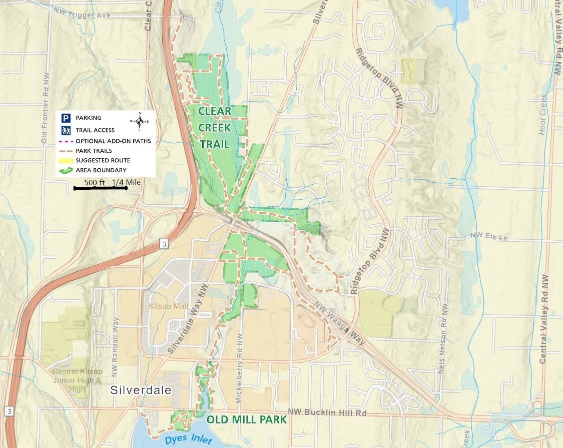
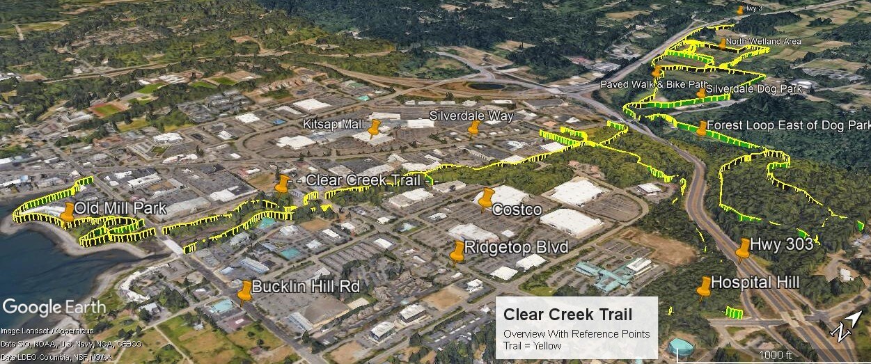
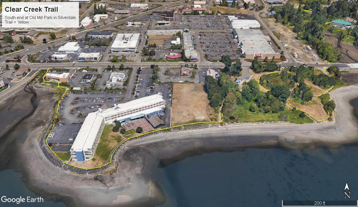
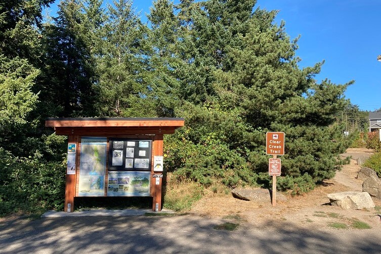
If you are only familiar with one trail in Kitsap County it is probably the Clear Creek Trail.  Clearly signed and easy to spot if you walk, ride, or drive through the Silverdale area, Most people have likely been on a section of the trail.

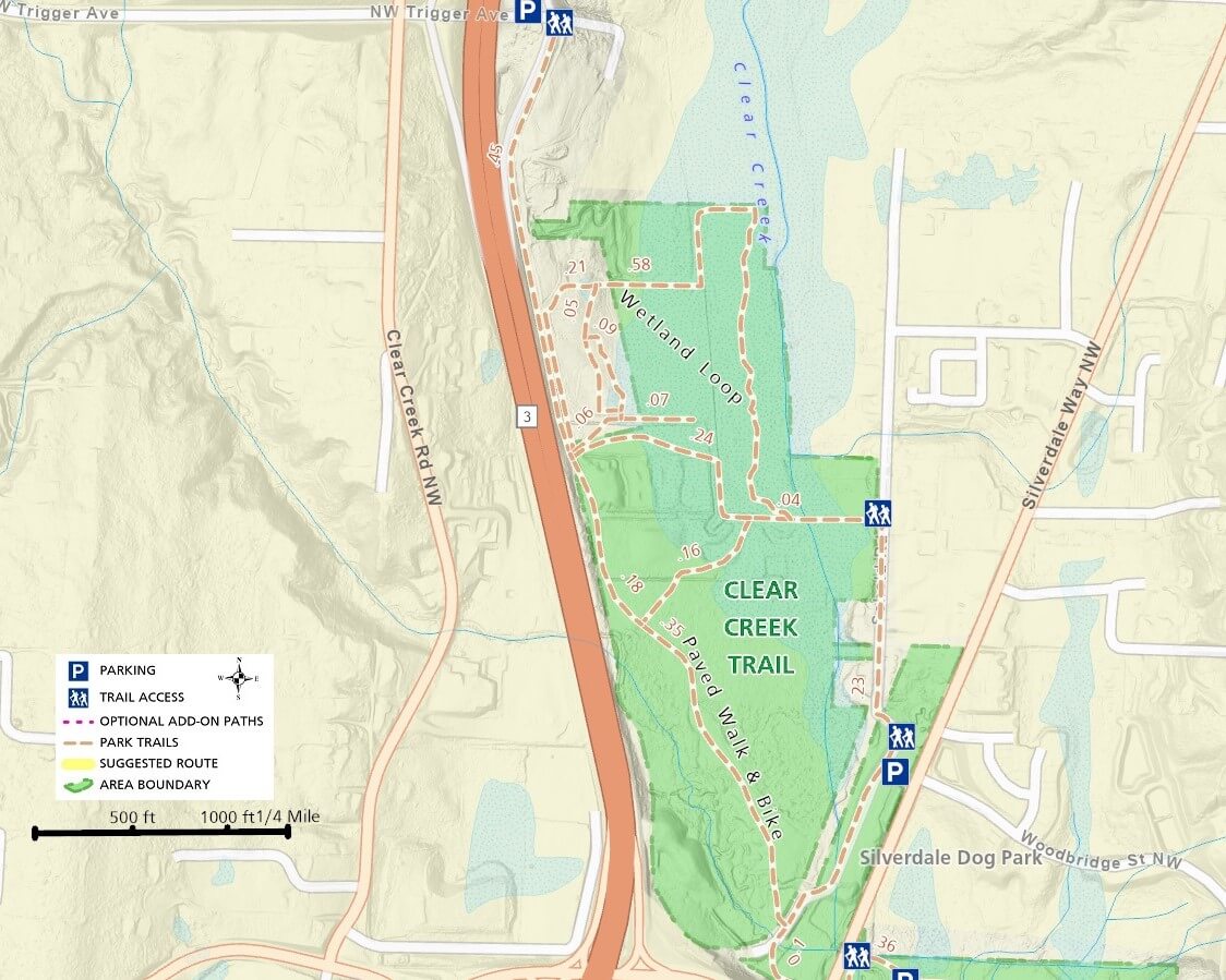
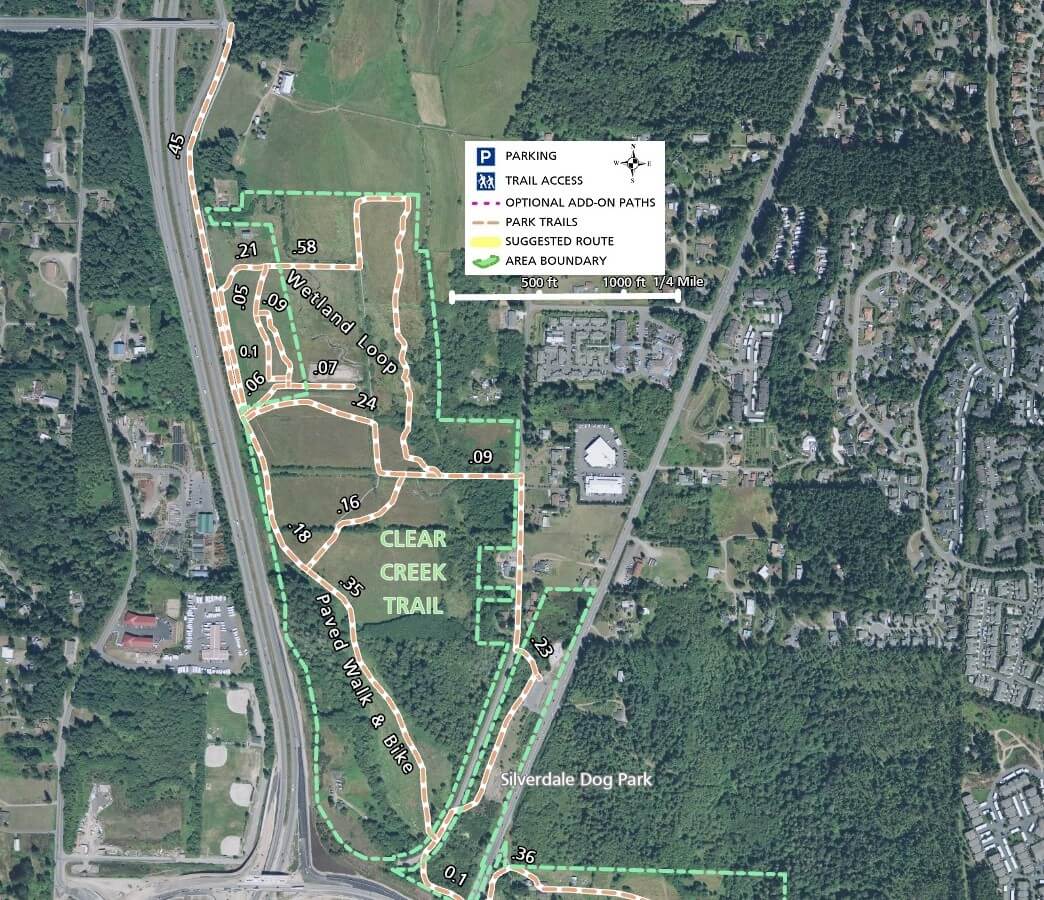
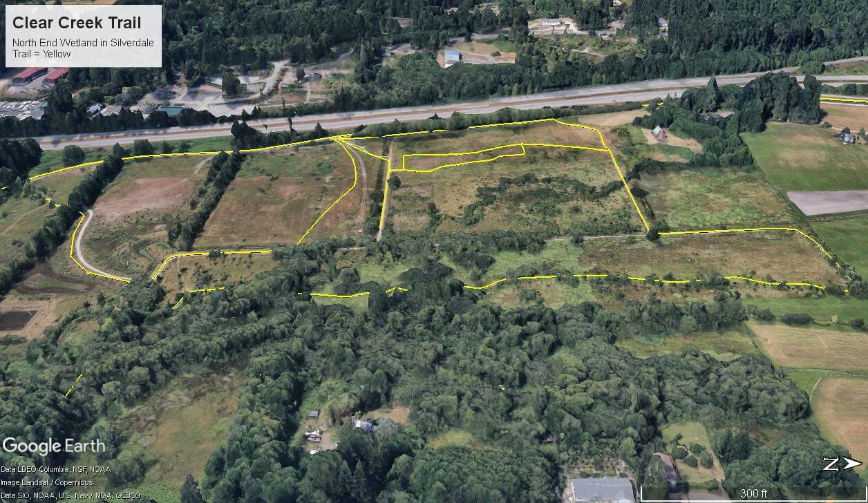
The section that most people are familiar with is the northern section adjacent to the Silverdale Dog Park on Silverdale Way just northeast of the Hwy 3 and Hwy 303 junction.

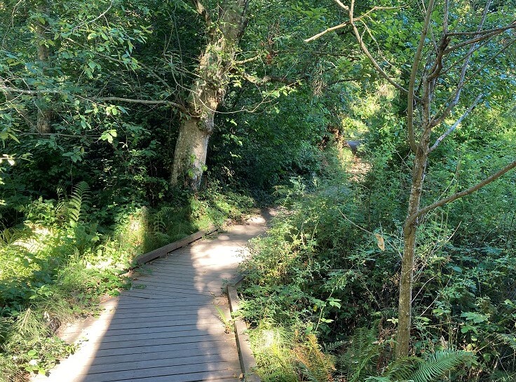
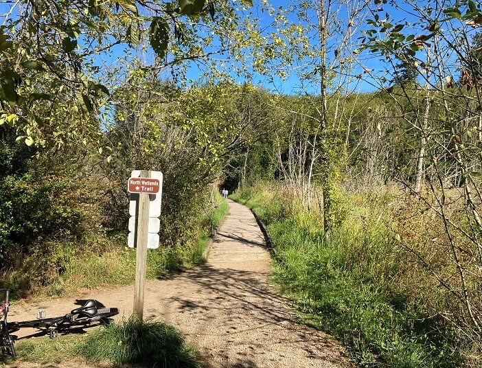
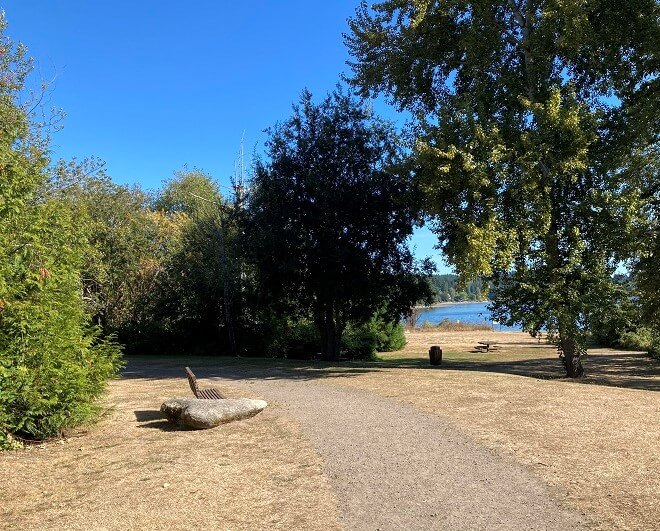
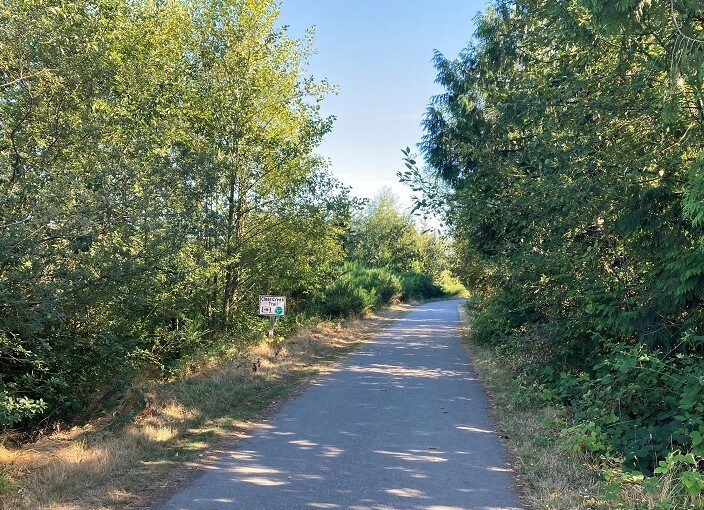
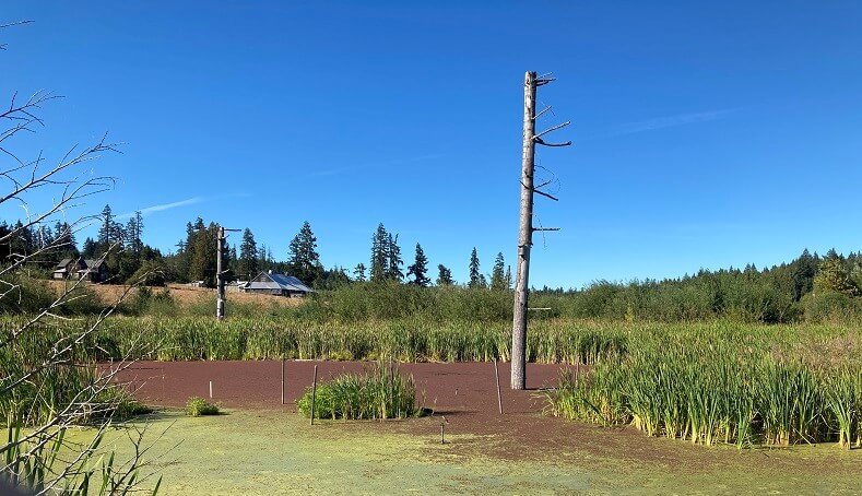
With mostly level trails, this area features a paved path and is suitable for walking, biking, and even strollers.  Other trails leading from the parking area cut across wide open grassland and wetland areas with boardwalks, gravel, and natural surface paths.

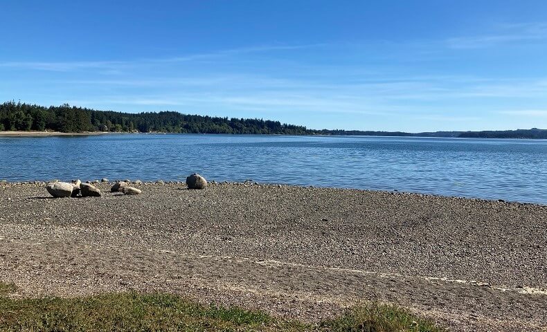
This area is quite scenic and earns its reputation as a great place to visit.  It can get crowded and the parking area will likely fill up on a warm sunny day.  For this reason, most of the trails through this area, with the exception of the paved trail, are not good for biking.


Mountain bikers may find the trail on the other side of Silverdale Way more attractive with far fewer people and more hills through the forest.  The main trail starts as single track, but turns into a wider gravel road and ultimately connects to a very narrow forest loop back towards the starting point.

Just on the other side of Hwy 303 and across Silverdale Way from the Kitsap Mall is a continuous section of trail that follows Clear Creek to its southern end in Old Mill Park on Dyes Inlet.

One spur that is worth taking, especially on a bike, is the Hospital Hill spur, more or less following Hwy 303 towards Harrison Hospital.

At any point, you can leave the trail at a cross street and end your route or continue on to another section of trail.

People who live, work, and shop in the area probably have particular sections they walk regularly.


Additional Maps

The maps below provide a different perspective on the Clear Creek Trail with satellite imagery.

3D Maps

See the maps below for more realistic 3D perspective views of the Clear Creek Trail system

For more information, visit the authoritative Clear Creek Trail page